


Click Image to Enlarge
North Carolina Counties
North Carolina is divided into one hundred counties. The establishment of North Carolina counties stretches over 240 years, beginning in 1668 with the creation of Albemarle County and ending with the 1911 creation of Avery and Hoke counties. Five counties have been divided or abolished altogether, the last being Dobbs County in 1791.Caldwell County, North Carolina
Caldwell County Education, Geography, and History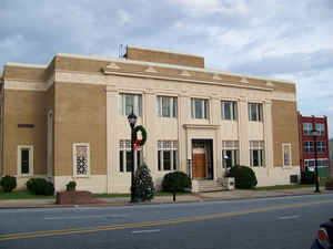
Caldwell County is a county located in the state of North Carolina. Based on the 2010 census, the population was 83,029. Its county seat
is Lenoir.
Caldwell County is part of the Hickory-Lenoir-Morganton, NC Metropolitan Statistical Area.
Etymology - Origin of Caldwell County Name
It was named in honor of Joseph Caldwell, the first president of the University of North Carolina He strongly advocated a public school system and a railroad across the center of the State from Morehead City to Tennessee.
Demographics:
County QuickFacts: CensusBureau Quick Facts
Caldwell County History
Caldwell was formed in 1841 from Burke and Wilkes. It was named in honor of Joseph Caldwell, the first president of the University of North Carolina He strongly advocated a public school system and a railroad across the center of the State from Morehead City to Tennessee. It is in the west central section of the State and is bounded by Alexander, Catawba, Burke, Avery, Watauga and Wilkes counties. The present land area is 471.60 square miles and the 2000 population was 77,386. The court was ordered to be held at the store of George Powell near the house of George Smith, Jr., until a courthouse was erected. Commissioners were named to select a site as near the center as possible, acquire land and a town, and erect a courthouse. Lenoir, named in honor of William Lenoir, is the county seat.
Geography: Land and Water
As reported by the Census Bureau, the county has a total area of 474 square miles (1,230 km2), of which 472 square miles (1,220 km2) is
land and 2.7 square miles (7.0 km2) (0.6%) is water.
Caldwell County is divided into three distinct geographic sections: the Blue Ridge Mountains, which dominate the northern and western parts of
the county; the gently rolling Piedmont country in the middle and southern parts of the county; and the Brushy Mountains, an isolated remnant
of the Blue Ridge Mountains. The "Brushies", as they are often called, run across much of Caldwell County's eastern section. Hibriten
Mountain, located within the city limits of Lenoir, the county's largest city, marks the western end of the Brushy Mountain range. In the
western part of the county is the Wilson Creek area.
Neighboring Counties
Bordering counties are as follows:
- Watauga County - north
- Wilkes County - northeast
- Alexander County - east
- Catawba County - southeast
- Burke County - south
- Avery County - northwest
Education


Click Image to Enlarge
