


Click Image to Enlarge
North Carolina Counties
North Carolina is divided into one hundred counties. The establishment of North Carolina counties stretches over 240 years, beginning in 1668 with the creation of Albemarle County and ending with the 1911 creation of Avery and Hoke counties. Five counties have been divided or abolished altogether, the last being Dobbs County in 1791.Haywood County, North Carolina
Haywood County Education, Geography, and History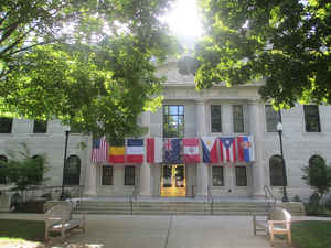
Haywood County is a county in the western portion of the state of North Carolina. Based on the 2010 census, the population was 59,036.
Its county seat and largest city is Waynesville.
Haywood County is part of the Asheville, NC Metropolitan Statistical Area.
Etymology - Origin of Haywood County Name
It was named in honor of John Haywood, Treasurer of North Carolina, 1787-1827.
Demographics:
County QuickFacts: CensusBureau Quick Facts
Haywood County History
Haywood was formed in 1808 from Buncombe. It was named in honor of John Haywood, Treasurer of North Carolina, 1787-1827. It is in the western section of the State and is bounded by the state of Tennessee and Madison, Buncombe, Transylvania, Jackson and Swain counties. The present land area is 553.66 square miles and the 2000 population was 54,033. The first court was ordered to be held at Mount Prospect, at which time the justices could decide on some other place for holding court until a courthouse could be erected. In 1809 the justices of the peace were authorized to appoint commissioners to erect the courthouse: "In the erection of the public buildings at Mount Prospect there was laid the foundation of the little city of Waynesville. In the record of the court of pleas and quarter sessions the name of Waynesville occurs first in 1811." Waynesville was confirmed as a town by legislative act in 1810. Waynesville is the county seat.
Geography: Land and Water
As reported by the Census Bureau, the county has a total area of 555 square miles (1,440 km2), of which 554 square miles (1,430 km2) is
land and 0.9 square miles (2.3 km2) (0.2%) is water.
The Pigeon River originates in Haywood County. It is the only county in North Carolina that all water flows out while none flows in.
Haywood County is situated amidst the Blue Ridge Mountains and contains parts of several major subranges of the Blue Ridge, namely the Great
Smoky Mountains in the west and the Plott Balsams and Great Balsam Mountains in the south. Notable peaks in the county include Cold Mountain,
at 6,030 feet (1,840 m), Mount Sterling, at 5,835 feet (1,779 m), and Richland Balsam, at 6,410 feet (1,950 m) in elevation. Mt. Guyot, the
county's highest point at 6,621 feet (2,018 m), is the 4th highest mountain east of the Mississippi River. Black Balsam Knob, in the Great
Balsam Mountains in the southeastern section of the county, is the highest grassy bald in the entire Appalachian range. Haywood County is
believed to be the highest county (by mean elevation) east of the Mississippi River, with a mean elevation of 3600 feet (1095m).
A portion of Great Smoky Mountains National Park is in the northwestern section of the county, north of Maggie Valley. Along with several
mountains rising to over 6,000 feet (1,800 m) in elevation, the Haywood area of the Smokies includes Cataloochee, which is home to a large
campground and several historical structures dating to the 19th and early 20th centuries. Other protected areas include substantial sections
of the Pisgah National Forest in the far northeastern and southern parts of the county.
Neighboring Counties
Bordering counties are as follows:
- Cocke County, Tennessee - north
- Madison County - northeast
- Buncombe County - east
- Henderson County, North Carolina - southeast
- Transylvania County - south
- Jackson County - southwest
- Swain County - west
- Sevier County, Tennessee - northwest
Education
Haywood County Schools has 16 schools ranging from pre-kindergarten to twelfth grade. Those are separated into four high schools, three middle schools, and nine elementary schools.


Click Image to Enlarge
