


Click Image to Enlarge
North Carolina Counties
North Carolina is divided into one hundred counties. The establishment of North Carolina counties stretches over 240 years, beginning in 1668 with the creation of Albemarle County and ending with the 1911 creation of Avery and Hoke counties. Five counties have been divided or abolished altogether, the last being Dobbs County in 1791.McDowell County, North Carolina
McDowell County Education, Geography, and History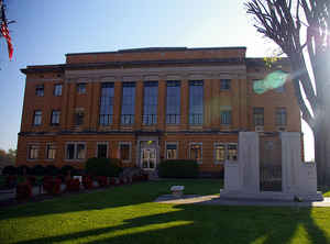
McDowell County is a county located in the state of North Carolina. Based on the 2010 census, the population was 44,996. Its county seat is Marion.
McDowell County comprises the Marion, NC Micropolitan Statistical Area, which is also included in the Hickory-Lenoir, NC Combined Statistical Area.
Etymology - Origin of McDowell County Name
t was named in honor of Colonel Joseph McDowell, an officer of the Revolution.
Demographics:
County QuickFacts: CensusBureau Quick Facts
McDowell County History
McDowell was formed in 1842 from Rutherford and Burke. It was named in honor of Colonel Joseph McDowell, an officer of the Revolution. It is in the west central section of the State and is bounded by Burke, Rutherford, Henderson, Buncombe, Yancey, Mitchell and Avery counties. The present land area is 441.68 square miles and the 2000 population was 42,151. The court was ordered to be held at the home of Jonathan L. Carson until the county seat could be established. The act also named commissioners to select a site as near the center of the county as possible, acquire land, lay out a town by the name of Marion, and erect a courthouse. Marion is the county seat.
Geography: Land and Water
As reported by the Census Bureau, the county has a total area of 446 square miles (1,160 km2), of which 441 square miles (1,140 km2) is
land and 5.4 square miles (14 km2) (1.2%) is water.
Numerous small creeks and streams flow through the county. The Catawba River crosses the county and empties into Lake James. It flows over
Catawba Falls on its way, which is accessible to the public. Other waterfalls can be found in the county, such as Toms Creek Falls. Almost
half of the county, including the two aforementioned waterfalls, is located inside the Pisgah National Forest. Linville Caverns, North
Carolina's only limestone cavern system open to the public, is located in the far northern part of the county.
Geologically, McDowell County is located within the southern Appalachian Mountains region. The Blue Ridge Parkway follows the northwestern
boundary of the county. McDowell County rises rapidly from the Piedmont (United States) in its extreme eastern border where elevations average
about 1200 feet above sea level, to the Blue Ridge Mountains in the north and west. Its highest point is Pinnacle in the Blue Ridge, 5,665
feet above sea level, also considered the southernmost tip of the Black Mountains, the highest ridge in eastern America. Much of the county
lies in the Foothills (North Carolina) region of Western North Carolina.
Neighboring Counties
Bordering counties are as follows:
- Mitchell County - north
- Avery County - north
- Burke County - east
- Rutherford County - south
- Buncombe County - west
- Yancey County - northwest
Education


Click Image to Enlarge
