


Click Image to Enlarge
North Carolina Counties
North Carolina is divided into one hundred counties. The establishment of North Carolina counties stretches over 240 years, beginning in 1668 with the creation of Albemarle County and ending with the 1911 creation of Avery and Hoke counties. Five counties have been divided or abolished altogether, the last being Dobbs County in 1791.Rockingham County, North Carolina
Rockingham County Education, Geography, and History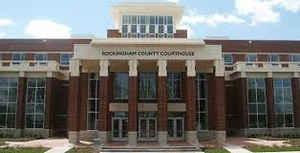
Rockingham County is a county located in the state of North Carolina. Based on the 2010 census, the population was 93,643. Its county
seat is Wentworth. The county is known as "North Carolina's North Star."
Rockingham County is included in the Greensboro-High Point, NC Metropolitan Statistical Area, which is also included in the
Greensboro-Winston-Salem-High Point, NC Combined Statistical Area.
Etymology - Origin of Rockingham County Name
It was named in honor of Charles Watson-Wentworth, Second Marquis of Rockingham, who was a leader of a party in the British Parliament which advocated American independence. He was Prime Minister when the Stamp Act was repealed.
Demographics:
County QuickFacts: CensusBureau Quick Facts
Rockingham County History
Rockingham was formed in 1785 from Guilford. It was named in honor of Charles Watson-Wentworth, Second Marquis of Rockingham, who was a leader of a party in the British Parliament which advocated American independence. He was Prime Minister when the Stamp Act was repealed. It is in the north central section of the State and is bounded by Caswell, Guilford and Stokes counties and the State of Virginia. The present land area is 566.44 square miles and the 2000 population was 91,928. The first court was held at the home of Adam Tate, at which time the justices were to decide on the place for holding future courts until the courthouse could be erected. In 1787 an act was passed which directed the courthouse to be erected on the land of Charles Mitchell on the east side of Big Rock House Creek. In 1796 an act was passed authorizing the purchase of land from Robert Galloway & Company, where public buildings were situated, and the community of Wentworth was established. In 1797 an act was passed suspending operations on the Wentworth courthouse. In 1798 commissioners were named to establish Wentworth on land given by Robert Galloway for that purpose. The first court was held at Wentworth in May, 1799. Wentworth is the county seat.
Geography: Land and Water
As reported by the Census Bureau, the county has a total area of 573 square miles (1,480 km2), of which 566 square miles (1,470 km2) is
land and 7.2 square miles (19 km2) (1.2%) is water.
The Dan River and Haw River drain the county.
Rockingham County has a municipal airport eight miles (13 km) northwest of Reidsville called Shiloh Airport, which has a paved 5,000-foot
(1,500 m) runway, a fixed base operation, and hangar space.
Neighboring Counties
Bordering counties are as follows:
- Pittsylvania County, Virginia - northeast
- Caswell County - east
- Alamance County - southeast
- Guilford County - south
- Forsyth County - southwest
- Stokes County - west
- Henry County, Virginia - northwest
Education
All public schools in Rockingham County are a part of Rockingham County Schools. The area includes government elementary, middle, and high schools including 25 different schools


Click Image to Enlarge
