


Click Image to Enlarge
North Carolina Counties
North Carolina is divided into one hundred counties. The establishment of North Carolina counties stretches over 240 years, beginning in 1668 with the creation of Albemarle County and ending with the 1911 creation of Avery and Hoke counties. Five counties have been divided or abolished altogether, the last being Dobbs County in 1791.Tyrrell County, North Carolina
Tyrrell County Education, Geography, and History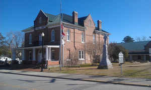
Tyrrell County is a county located in the state of North Carolina. Based on the 2010 census, the population was 4,407 making it the least
populous county in the state. Its county seat is Columbia. The county was created in 1729 as Tyrrell Precinct and gained county status in
1739.
Tyrrell County is included in the Kill Devil Hills, NC Micropolitan Statistical Area, which is also included in the Virginia Beach-Norfolk,
VA-NC Combined Statistical Area.
Etymology - Origin of Tyrrell County Name
It was named in honor of Sir John Tyrrell, who at one time was one of the Lords Proprietors.
Demographics:
County QuickFacts: CensusBureau Quick Facts
Tyrrell County History
Tyrrell was formed in 1729 from Chowan, Currituck and Pasquotank. It was named in honor of Sir John Tyrrell, who at one time was one of the Lords Proprietors. It is in the eastern section of the State and is bounded by Dare, Hyde and Washington counties and the Albemarle Sound. The present land area is 389.91 square miles and the 2000 population was 4,149. It is quite evident that a courthouse was not built until some time between 1740 to 1751. Prior to this date courts were held in private homes, but generally at the home of William Frayley, (also spelled Frailes, Frylies or Fryleys). In 1751, court was held at the courthouse on Kindrick's Creek. Between 1774 and 1776, court was held at the home of Benjamin Spruill. Between 1777 and 1800 court was held at the courthouse on Scuppernong River. In 1799, commissioners were named to erect the public buildings in Elizabeth Town. On July 28, 1800, the first court was held in Elizabeth Town. In 1801, Elizabeth Town was changed to Columbia, which was recorded as the county seat in 1802. Columbia is the county seat.
Geography: Land and Water
As reported by the Census Bureau, the county has a total area of 594 square miles (1,540 km2), of which 389 square miles (1,010 km2) is land and 205 square miles (530 km2) (35%) is water.
Neighboring Counties
Bordering counties are as follows:
- Washington County - west
- Dare County - east
- Hyde County - south
Education


Click Image to Enlarge
