


Click Image to Enlarge
North Carolina Counties
North Carolina is divided into one hundred counties. The establishment of North Carolina counties stretches over 240 years, beginning in 1668 with the creation of Albemarle County and ending with the 1911 creation of Avery and Hoke counties. Five counties have been divided or abolished altogether, the last being Dobbs County in 1791.Wilson County, North Carolina
Wilson County Education, Geography, and History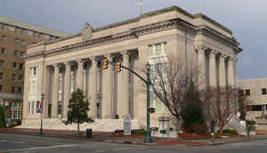
Wilson County is a county located in the state of North Carolina. Based on the 2010 census, the population was 81,234. The county seat is
Wilson.
Wilson County comprises the Wilson, NC Micropolitan Statistical Area, which is also included in the Rocky Mount-Wilson-Roanoke Rapids, NC
Combined Statistical Area
Etymology - Origin of Wilson County Name
It was named in honor of Louis D. Wilson, many times a member of the Legislature from Edgecombe County, a soldier of the Mexican War who died near Vera Cruz of fever, and a benefactor of the poor of his native county.
Demographics:
County QuickFacts: CensusBureau Quick Facts
Wilson County History
Wilson was formed in 1855 from Edgecombe, Nash, Johnston and Wayne. It was named in honor of Louis D. Wilson, many times a member of the Legislature from Edgecombe County, a soldier of the Mexican War who died near Vera Cruz of fever, and a benefactor of the poor of his native county. It is in the east central section of the State and is bounded by Pitt, Greene, Wayne, Johnston, Nash and Edgecombe counties. The present land area is 371.09 square miles and the 2000 population was 73,811. The court was ordered to be held at Benjamin Barden's store in Wilson, a village already established, until a courthouse could be built. Commissioners were to acquire a site within one-fourth of a mile of the town of Wilson and erect a courthouse.
Geography: Land and Water
As reported by the Census Bureau, the county has a total area of 374 square miles (970 km2), of which 368 square miles (950 km2) is land and 5.6 square miles (15 km2) (1.5%) is water.
Neighboring Counties
Bordering counties are as follows:
- Nash County - north
- Edgecombe County - northeast
- Pitt County - east
- Greene County - southeast
- Wayne County - south
- Johnston County - southwest
Education


Click Image to Enlarge
