


Click Image to Enlarge
Ohio Counties
There is eighty-eight counties in the state of Ohio. Washington County the oldest in the state established on July 27, 1788. Noble County was formed on March 11, 1851 from portions of Guernsey, Morgan, Monroe and Washington counties. It was the last county to be formed in Ohio and, therefore, represents the youngest county in the state.Cuyahoga County, Ohio
Cuyahoga County Education, Geography, and History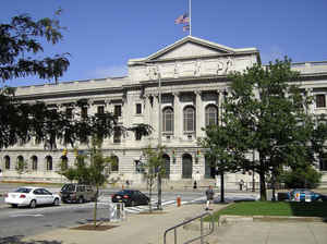
Cuyahoga County is a county located in the state of Ohio. Based on the 2010 census, the population was 1,280,122, making it the most
populous county in Ohio. Its county seat is Cleveland. In 2014, the county's estimated population was 1,259,828. The county is named after the
Iroquoian word Cuyahoga, which means 'crooked river'. The name is also assigned to the Cuyahoga River, which bisects the county.
Cuyahoga County is included in the Cleveland-Elyria, OH Metropolitan Statistical Area.
Etymology - Origin of Cuyahoga County Name
Residents took the county's name from the Indian word "Cuyahoga" or "crooked river."
Demographics:
County QuickFacts: CensusBureau Quick Facts
Cuyahoga County History
On January 16, 1810, the Ohio government established Cuyahoga County. Residents took the county's name from the Indian word "Cuyahoga" or "crooked river." The state made Cuyahoga County from part of Geauga County. Cuyahoga County was originally part of the Connecticut Western Reserve, and Moses
Cleaveland brought the first white settlers to the area in 1796. He established the city of Cleveland that same year. With completion of the Ohio and Erie Canal and its location on Lake Erie, Cleveland prospered as a trade center, and the city also became a major industrial site in the late 1800s.
Cuyahoga County is located in the northern portion of Ohio and covers 458 square miles. Its northern border is Lake Erie. The county has experienced a small decline in population, losing 1.3 percent of its 1,398,169 residents between 1995 and 2000. As of 2000, Cuyahoga County still ranked as Ohio's
most heavily populated county, averaging almost 3,044 residents per square mile. Cleveland is the county seat and is also the county's largest city, with a population of 447,459 people in 2000. Cleveland is unusual in comparison to Ohio's other large cities, as it has lost population, nearly thirty
thousand people between 1990 and 2000. This decline has principally resulted from the loss of industrial jobs in recent years. The next largest city in Cuyahoga County is Parma, a suburb of Cleveland. The county is ethnically diverse, as people from all around the world came to Cleveland during the
late 1800s and the early 1900s looking for work in the city's industries.
Approximately forty-five percent of Cuyahoga County's residents earn their livings by working in service industries, including in health care and in communications. Manufacturing and sales combine for almost fifty percent of the county's employment opportunities. Some residents work in the shipping
industry, transferring coal, iron ore, and steel across the Great Lakes. A new tourism industry has blossomed in the county, especially with the construction of the Rock and Roll Hall of Fame Museum in Cleveland. The county also has three Major League professional sports franchises, the Cleveland
Browns, the Cleveland Cavaliers, and the Cleveland Indians, encouraging tourism. The county's average income was approximately 32,200 dollars per person in 1999, with almost fourteen percent of the population living in poverty. In Cleveland, the poverty rate was much higher. Until 2005, a greater
percentage of Clevelanders lived in poverty than residents of any other city.
Most voters in Cuyahoga County claim to be independents, yet in recent years, they have overwhelmingly supported Democratic candidates at the national level.
Among the county's more famous residents were comedian Bob Hope and President of the United States James Garfield. Cuyahoga County also was the home of John D. Rockefeller, the founder of Standard Oil, as well as several important inventors, scientists, and business owners, including Charles F.
Brush, Alexander Winton, Marcus Hanna, Jeptha H. Wade, and Thomas A. White. Several Ohio governors also lived in the county, including Reuben Wood, John Brough, Myron T. Herrick, Harry L. Davis, Frank J. Lausche, Thomas J. Herbert, Richard F. Celeste, and George Voinovich.
Sources
Cuyahoga County, Ohio History Central, July 23, 2008,
http://www.ohiohistorycentral.org/entry.php?rec=1918&nm=Cuyahoga-County
Geography: Land and Water
As reported by the Census Bureau, the county has a total area of 1,246 square miles (3,230 km2), of which 457 square miles (1,180 km2) is land and 788 square miles (2,040 km2) (63%) is water. It is the second-largest county in Ohio by total area. A portion of Cuyahoga Valley National Park is located in the southeastern portion of the county.
Neighboring Counties
Bordering counties are as follows:
- Across Lake Erie lies Chatham-Kent and Elgin County, Ontario,
- Canada (north)
- Lake County (northeast)
- Geauga County (east)
- Summit County (southeast)
- Medina County (southwest)
- Lorain County (west)
- Portage County (southeast corner)
Education
Colleges and universities
Cuyahoga County is home to a number of higher education institutions, including:
Baldwin Wallace University (Berea)
Cleveland Bartending School Cleveland Heights
Case Western Reserve University (Cleveland)
Cleveland Institute of Art (Cleveland)
Cleveland Institute of Music (Cleveland)
Cleveland State University (Cleveland and Westlake)
Cuyahoga Community College (Cleveland, Highland Hills, and Parma)
DeVry University (Seven Hills)
John Carroll University (University Heights)
Notre Dame College (South Euclid)
Kent State University College of Podiatric Medicine (Independence)
Stautzenberger College, Brecksville (Brecksville)
Ursuline College (Pepper Pike)


Click Image to Enlarge
