


Click Image to Enlarge
Ohio Counties
There is eighty-eight counties in the state of Ohio. Washington County the oldest in the state established on July 27, 1788. Noble County was formed on March 11, 1851 from portions of Guernsey, Morgan, Monroe and Washington counties. It was the last county to be formed in Ohio and, therefore, represents the youngest county in the state.Hardin County, Ohio
Hardin County Education, Geography, and History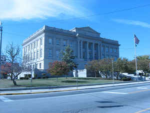
Hardin County is a county located in the state of Ohio. Based on the 2010 census, the population was 32,058. Its county seat is Kenton. The county was created in 1820 and later organized in 1833. It is named for John Hardin, an officer in the American Revolution.
Etymology - Origin of Hardin County Name
Residents named the county in honor of John Hardin, a hero of the American Revolution.
Demographics:
County QuickFacts: CensusBureau Quick Facts
Hardin County History
On February 12, 1820, the Ohio government authorized the creation of Hardin County. Residents named the county in honor of John Hardin, a hero of the American Revolution. Previously, the county had been part of land reserved to Ohio's Indian people, under the Treaty of Greeneville.
Hardin County is located in northwestern Ohio. It is predominantly rural, with less than one percent of the county's 470 square miles consisting of urban areas. The county seat is Kenton, named for backwoodsmen Simon Kenton. With a population of 8,336 people, Kenton was the county's largest
community in 2000. Many residents of Ohio's rural communities are seeking better lives and more opportunities in the state's cities, but Hardin County's population seems to be remaining stable. The county experienced a 2.7 percent population growth rate between 1990 and 2000, bringing the total
number of residents up to 31,945. The county averages sixty-eight people per square mile.
Farming is the largest employer in Hardin County, with manufacturing businesses and retail positions following closely behind. In 1999, the per capita income in the county was almost twenty thousand dollars, with 11.5 percent of the people living in poverty.
Most voters in Hardin County claim to be independents, yet in recent years, they have overwhelmingly supported Republican Party candidates at the national level.
Sources
Hardin County, Ohio History Central, July 23, 2008,
http://www.ohiohistorycentral.org/entry.php?rec=1940&nm=Hardin-County
Geography: Land and Water
As reported by the Census Bureau, the county has a total area of 471 square miles (1,220 km2), of which 470 square miles (1,200 km2) is land and 0.2 square miles (0.52 km2) (0.1%) is water.
Neighboring Counties
Bordering counties are as follows:
- Hancock County (north)
- Wyandot County (northeast)
- Marion County (east)
- Union County (southeast)
- Logan County (south)
- Auglaize County (southwest)
- Allen County (northwest)
Education
The county is home to Ohio Northern University.


Click Image to Enlarge
