


Click Image to Enlarge
Ohio Counties
There is eighty-eight counties in the state of Ohio. Washington County the oldest in the state established on July 27, 1788. Noble County was formed on March 11, 1851 from portions of Guernsey, Morgan, Monroe and Washington counties. It was the last county to be formed in Ohio and, therefore, represents the youngest county in the state.Logan County, Ohio
Logan County Education, Geography, and History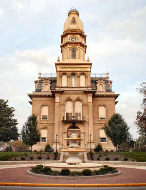
Logan County is a county in the state of Ohio. Based on the 2010 census, the population was 45,858. The county seat is Bellefontaine. The
county is named for Benjamin Logan, who fought Native Americans in the area.
Logan County comprises the Bellefontaine, OH Micropolitan Statistical Area, which is also included in the Columbus-Marion-Zanesville, OH
Combined Statistical Area.
Etymology - Origin of Logan County Name
Residents named the county in honor of Benjamin Logan, a hero of the American Revolution and wars with Ohio's Indian population.
Demographics:
County QuickFacts: CensusBureau Quick Facts
Logan County History
On December 30, 1817, the Ohio government authorized the creation of Logan County. Residents named the county in honor of Benjamin Logan, a hero of the American Revolution and wars with Ohio's Indian population. Previously, the county had been part of land reserved to Ohio's Indian people, under
the Treaty of Greeneville.
Logan County is located in northwestern Ohio. It is predominantly rural, with less than one percent of the county's 458 square miles consisting of urban areas. The county seat is Bellefontaine. With a population of 13,069 people, Bellefontaine was the county's largest community in 2000. Many
residents of Ohio's rural communities are seeking better lives and more opportunities in the state's cities, but Logan County's population grew between 1990 and 2000. The county experienced an 8.7 percent population growth rate between 1990 and 2000, bringing the total number of residents up to
46,005. The county averages just over one hundred people per square mile.
Manufacturing businesses and service industries, such as health care and tourism, are Logan County's largest employers. Retail positions and farming rank third and fourth, respectively. Among the county's tourist attractions are Lake State Park, the Zane Caverns, and the Ohio Caverns. In 1999, the
per capita income in the county was almost twenty-five thousand dollars, with 9.5 percent of the people living in poverty.
Most voters in Logan County claim to be independents, yet in recent years, they have overwhelmingly supported Republican Party candidates at the national level.
Logan County's Campbell Hill, 1,548.81 feet above sea level, is the highest point in the United States between the Rocky Mountains and the Allegheny Mountains
Sources
Logan County, Ohio History Central, July 24, 2008,
http://www.ohiohistorycentral.org/entry.php?rec=1961&nm=Logan-County
Geography: Land and Water
As reported by the Census Bureau, the county has a total area of 467 square miles (1,210 km2), of which 458 square miles (1,190 km2) is land and 8.3 square miles (21 km2) (1.8%) is water. Campbell Hill, the highest natural point in Ohio at 1,549 feet (472 m), is located northeast of Bellefontaine.
Neighboring Counties
Bordering counties are as follows:
- Hardin County (north)
- Union County (east)
- Champaign County (south)
- Shelby County (west)
- Auglaize County (northwest)
Education


Click Image to Enlarge
