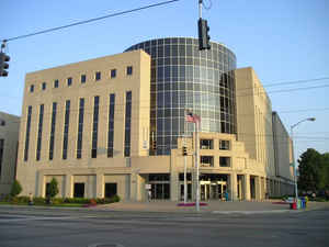
Ohio Counties
There is eighty-eight counties in the state of Ohio. Washington County the oldest in the state established on July 27, 1788. Noble County was formed on March 11, 1851 from portions of Guernsey, Morgan, Monroe and Washington counties. It was the last county to be formed in Ohio and, therefore, represents the youngest county in the state.Montgomery County, Ohio
Montgomery County Education, Geography, and History
 Montgomery County is a
county located in the state of Ohio. Based on the 2010 census, the population was 535,153, making it the fifth-most populous county in Ohio.
The county seat is Dayton. The county was named in honor of Richard Montgomery, an American Revolutionary War general killed in 1775 while
attempting to capture Quebec City, Canada.
Montgomery County is part of the Dayton, Ohio Metropolitan Statistical Area.
Etymology - Origin of Montgomery County Name
Residents named the county in honor of Richard Montgomery, a hero of the American Revolution.
Demographics:
County QuickFacts: CensusBureau Quick Facts
Montgomery County History
On March 24, 1803, the Ohio legislature authorized the creation of Montgomery County. Residents named the county in honor of Richard Montgomery, a hero of the American Revolution. Previously, the county had been parts of Ross and Hamilton Counties. Wilbur and Orville Wright owned a bicycle shop
in Dayton, the county seat, during the late nineteenth and early twentieth century. It was here that the Wrights developed the first powered aircraft to fly successfully
Montgomery County is located in western Ohio. It is predominantly rural. Seventeen percent of the county's 462 square miles consist of urban areas. With a population of 166,179 people, Dayton was the county's largest community in 2000. The county experienced a 2.6 percent decline in population
between 1990 and 2000. There were 559, 062 people living in Montgomery County in 2000. The county averages 1,210 people per square mile.
Montgomery County flourished during the nineteenth century. With the completion of the Miami and Erie Canal in 1829, Dayton was connected to Cincinnati. In addition, nine turnpikes connected Dayton to other parts of the state. Because it was a transportation hub, Montgomery County was heavily
involved in Ohio's early industrialization. By the late 1800s, the county had become the home of many different businesses. There were a number of newspapers and journals that fueled a publishing industry. Many of these publications dealt with either religious issues or agricultural interests. Some
examples include Christian World, Young Catholic Messenger, Ohio Bible Teacher, as well as Farmer's Home, the Ohio Swine Journal, and the Ohio Poultry Journal. Many other businesses were related to agriculture and included mills and a number of companies manufacturing farm implements. Among the best
known in the nineteenth century was the Buckeye Mower and Reaper Company. In the 1880s, John Patterson opened the National Cash Register Company in Dayton.
Today, service industries, such as health care and tourism, retail positions, and manufacturing businesses are Montgomery County's largest employers. Government ranks a distant fourth. Most government employees work at Wright-Patterson Air Force Base. In 1999, the per capita income in the county was
28,113 dollars, with 11.1 percent of the people living in poverty.
Most voters in Montgomery County claim to be political independents.
Besides the Wright brothers, Montgomery County also was home to Ohio Governors James Cox and Charles Anderson. Paul Laurence Dunbar, a noted African-American author and poet lived in Dayton as well
Sources
Montgomery County, Ohio History Central, July 24, 2008,
http://www.ohiohistorycentral.org/entry.php?rec=1981&nm=Montgomery-County
Geography: Land and Water
As reported by the Census Bureau, the county has a total area of 464 square miles (1,200 km2), of which 462 square miles (1,200 km2) is land and 2.8 square miles (7.3 km2) (0.6%) is water.
Neighboring Counties
Bordering counties are as follows:
- Miami County (north)
- Clark County (northeast)
- Greene County (east)
- Warren County (south)
- Butler County (southwest)
- Preble County (west)
- Darke County (northwest)
Education
Post-secondary institutions
Public
Air Force Institute of Technology (actually located in Wright-Patterson AFB, Ohio).
Sinclair Community College
Wright State University (actually located in neighbouring Greene County, Ohio, but uses a Dayton address).
Private
University of Dayton
Kettering College of Medical Arts


