


Click Image to Enlarge
Ohio Counties
There is eighty-eight counties in the state of Ohio. Washington County the oldest in the state established on July 27, 1788. Noble County was formed on March 11, 1851 from portions of Guernsey, Morgan, Monroe and Washington counties. It was the last county to be formed in Ohio and, therefore, represents the youngest county in the state.Morgan County, Ohio
Morgan County Education, Geography, and History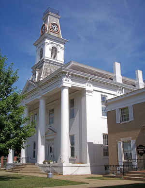
Morgan County is a county located in the state of Ohio. Based on the 2010 census, the population was 15,054, making it the fourth-least populous county in Ohio. Its county seat is McConnelsville. The county was created in 1817 and later organized in 1819. It is named for Daniel Morgan, an officer in the American Revolutionary War
Etymology - Origin of Morgan County Name
Residents named the county in honor of Daniel Morgan, a hero of the American Revolution.
Demographics:
County QuickFacts: CensusBureau Quick Facts
Morgan County History
On December 29, 1817, the Ohio government authorized the creation of Morgan County. Residents named the county in honor of Daniel Morgan, a hero of the American Revolution. The first whites settled in the county in 1790. They built a community known as Big Bottom. In 1791, Indians attacked the
settlement, killing twelve settlers. This event became known as the Big Bottom Massacre. The Ohio Historical Society commemorates the attack with a monument on the site.
Morgan County is located in eastern Ohio. It is predominantly rural, with less than one percent of the county's 418 square miles consisting of urban areas. The county is also in the heart of Appalachia. The county seat is McConnelsville. With a population of 1,676 people, McConnelsville was the
county's largest community in 2000. Unlike many of Ohio's more rural counties, Morgan County's population has increased in recent years. Between 1990 and 2000, the county's population grew by five percent, raising the total number of residents to 14,897 people in 2000. The county averages thirty-six
people per square mile, making it one of Ohio's least populous counties.
Agriculture is the largest employer in Morgan County. No other occupation draws more than 750 workers. During the nineteenth century, many McConnelsville residents earned their livings by transporting crops, manufactured goods, and people down the Muskingum River to the Ohio River. In 1999, the per
capita income in the county was 17,794 dollars, with 15.3 percent of the people living in poverty.
Most voters in Morgan County claim to be independents, yet in recent years, they have supported Republican Party candidates at the national level
Sources
Morgan County, Ohio History Central, July 24, 2008,
http://www.ohiohistorycentral.org/entry.php?rec=1982&nm=Morgan-County
Geography: Land and Water
As reported by the Census Bureau, the county has a total area of 422 square miles (1,090 km2), of which 416 square miles (1,080 km2) is land and 5.4 square miles (14 km2) (1.3%) is water.
Neighboring Counties
Bordering counties are as follows:
- Muskingum County (north)
- Noble County (northeast)
- Washington County (southeast)
- Athens County (southwest)
- Perry County (west)
Education


Click Image to Enlarge
