


Click Image to Enlarge
Ohio Counties
There is eighty-eight counties in the state of Ohio. Washington County the oldest in the state established on July 27, 1788. Noble County was formed on March 11, 1851 from portions of Guernsey, Morgan, Monroe and Washington counties. It was the last county to be formed in Ohio and, therefore, represents the youngest county in the state.Muskingum County, Ohio
Muskingum County Education, Geography, and History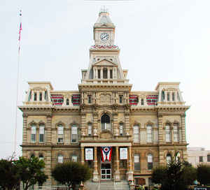
Muskingum County is a county located in the state of Ohio. Based on the 2010 census, the population was 86,074. Its county seat is
Zanesville. Nearly bisected by the Muskingum River, the county name is based on a Delaware American Indian word translated as "town by the
river" or "elk's eye".
Muskingum County comprises the Zanesville, OH Micropolitan Statistical Area, which is also included in the Columbus-Marion-Zanesville, OH
Combined Statistical Area.
Etymology - Origin of Muskingum County Name
The county's name came from an Indian word for "near the river."The Muskingum River flows through the county.
Demographics:
County QuickFacts: CensusBureau Quick Facts
Muskingum County History
On January 7, 1804, the Ohio government authorized the creation of Muskingum County. The county's name came from an Indian word for "near the river."The Muskingum River flows through the county. Located on Zane's Trace, the county grew quickly. In 1810, Zanesville, the county seat, became Ohio's
capital, replacing Chillicothe. The main reason for this change was an attempt by Democratic-Republicans in Ohio to solidify their control over eastern Ohio. The capital remained in Zanesville for only two years, returning to Chillicothe in 1812, before moving permanently to Columbus in 1816.
Muskingum County is located in eastern Ohio. It is predominantly rural, with less than one percent of the county's 665 square miles consisting of urban areas. With a population of 25,586 people, Zanesville was the county's largest community in 2000. The next largest urban area, Falls Township, had
only 8,585 residents that same year. Muskingum County experienced a slight increase in population- roughly 3.1 percent- between 1990 and 2000, raising the total number of residents to 84,585 people. Many residents of Ohio's rural communities are seeking better lives and more opportunities in the
state's cities, but Muskingum County seems to be remaining stable in population. The county averages 127 people per square mile.
The largest employers in Muskingum County are retail establishments, with manufacturing businesses a close second. The most important industry in the county during the second half of the nineteenth century was art pottery manufacturing. Samuel A. Weller became the most important manufacturer in
1890, when he began production in Zanesville. Most of his early products included simple items like flowerpots, cuspidors, and tableware. By 1905, more than five hundred workers found employment in Weller's plant. These workers produced three boxcars full of pottery every day, making Weller the
largest manufacturer of pottery in the world by the 1910s. Pottery manufacturing remains a vital component of Muskingum County's economy today. In 2003, many of Zanesville's residents found employment in various pottery establishments, including Fioriware Art Pottery, Zanesville Pottery and China,
Incorporated, and Robinson Ransbottom Pottery in nearby Roseville. Other businesses also flourish in the county, such as Volvo Trucks and Custom Vans of Zanesville. The county also enjoys a booming tourism industry, due to the pottery manufacturers, as well as the Longaberger Company, which produces
baskets in nearby Frazeysburg. People across the world collect Longaberger baskets. In 1999, the per capita income in the county was approximately twenty-two thousand dollars, with 14.4 percent of the people living in poverty.
Most voters in Muskingum County claim to be independents, yet in recent years, they have supported Republican Party candidates at the national level.
Among Muskingum County's more prominent residents was astronaut and United States Senator John Glenn. Glenn grew up in New Concord, Ohio, and attended Muskingum College. Author Zane Grey also lived in the county
Sources
Muskingum County, Ohio History Central, July 24, 2008,
http://www.ohiohistorycentral.org/entry.php?rec=1986&nm=Muskingum-County
Geography: Land and Water
As reported by the Census Bureau, the county has a total area of 673 square miles (1,740 km2), of which 665 square miles (1,720 km2) is land and 8.0 square miles (21 km2) (1.2%) is water. It is the fourth-largest county in Ohio by land area.
Neighboring Counties
Bordering counties are as follows:
- Coshocton County (north)
- Guernsey County (east)
- Noble County (southeast)
- Morgan County (south)
- Perry County (southwest)
- Licking County (west)
Education


Click Image to Enlarge
