


Click Image to Enlarge
Ohio Counties
There is eighty-eight counties in the state of Ohio. Washington County the oldest in the state established on July 27, 1788. Noble County was formed on March 11, 1851 from portions of Guernsey, Morgan, Monroe and Washington counties. It was the last county to be formed in Ohio and, therefore, represents the youngest county in the state.Paulding County, Ohio
Paulding County Education, Geography, and History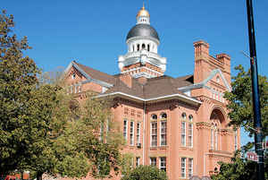
Paulding County is a county located in the state of Ohio. Based on the 2010 census, the population was 19,614. Its county seat is Paulding. The county was created in 1820 and later organized in 1839. It is named for John Paulding, one of the captors of Major John André in the American Revolutionary War.
Etymology - Origin of Paulding County Name
Residents named the county in honor of John Paulding, a hero of the American Revolution. Paulding helped capture Benedict Arnold, the most notorious traitor in American history.
Demographics:
County QuickFacts: CensusBureau Quick Facts
Paulding County History
On February 12, 1820, the Ohio government authorized the creation of Paulding County. Residents named the county in honor of John Paulding, a hero of the American Revolution. Paulding helped capture Benedict Arnold, the most notorious traitor in American history. Paulding County was originally
part of territory set aside for Ohio's Indian people by the Treaty of Greeneville. White settlement of the county occurred very slowly, due to the Great Black Swamp occupying most of the land. During the 1830s and 1840s, completion of the Miami and Erie Canal and the Wabash and Erie Canal helped
spur settlement, but still water from the Great Black Swamp and from a water reservoir for the canals covered much of the county. It was not until 1887 that residents were able to drain most of the Great Black Swamp and the reservoir, opening the land to farming and further settlement.
Paulding County is located in the northwestern part of Ohio. Its western border helps form the boundary between Ohio and Indiana. The county seat is Paulding, which is the largest city in the county with a population of 3,595 people in 2000. Less than one percent of the county's 416 square miles are
deemed to be urban. The county averages forty-nine people living in each square mile. Between 1990 and 2000, the county experienced a one percent decrease in population. This is typical of Ohio's more rural counties, as residents seek better opportunities in the state's larger cities. In 2000, the
county's residents numbered 20,293 people.
Most of Paulding County's residents find employment in agricultural positions. Manufacturing, government, and retail positions finish second, third, and fourth respectively. In 1999, the county's per capita income was 19,961 dollars, with 7.7 percent of the county's residents living below the
poverty level.
Most voters in Paulding County claim to be independents, yet in recent years, they have supported Republican Party candidates at the national level.
Sources
Paulding County, Ohio History Central, July 24, 2008,
http://www.ohiohistorycentral.org/entry.php?rec=1995&nm=Paulding-County
Geography: Land and Water
As reported by the Census Bureau, the county has a total area of 419 square miles (1,090 km2), of which 416 square miles (1,080 km2) is
land and 2.4 square miles (6.2 km2) (0.6%) is water.
The center of the county is 723 feet above sea level, and the rest of the county does not vary much from that. The land is the most level of
any county in the state, and plats look like a checkerboard, with roads every mile. This level terrain resulted in Paulding County being
entirely within the Great Black Swamp, unlike any other.
There are two major rivers, the Auglaize and the Maumee, as well as numerous small creeks. The largest bodies of water are manmade ponds.
Neighboring Counties
Bordering counties are as follows:
- Defiance County (north)
- Putnam County (east)
- Van Wert County (south)
- Allen County, Indiana (west)
Education
In 1971, the Ohio Board of Education revoked the charters of Payne, Blue Creek, Grover Hill and Auglaize-Brown school districts. Blue Creek
was itself the merger of Latty and Haviland schools only a few years prior. Payne, Blue Creek, and Grover Hill merged to form the Wayne Trace
school district, and Auglaize-Brown joined Paulding Exempted Village Schools.
Antwerp Local School District
Paulding Exempted Village School District
Wayne Trace Local School District
Vantage Career Center
In the late 1950s, Paulding Exempted Village Schools enacted a pay-as-you-go tax for school construction, designed to reduce overall taxes
by paying cash for school construction rather than paying high interest rates on bonds. The pay-as-you-go concept has been adopted in a number
of local government units in Ohio.
With students from kindergarten to high school at one location, the Paulding campus of PEVS is one of the largest schools in the state.


Click Image to Enlarge
