


Click Image to Enlarge
Ohio Counties
There is eighty-eight counties in the state of Ohio. Washington County the oldest in the state established on July 27, 1788. Noble County was formed on March 11, 1851 from portions of Guernsey, Morgan, Monroe and Washington counties. It was the last county to be formed in Ohio and, therefore, represents the youngest county in the state.Portage County, Ohio
Portage County Education, Geography, and History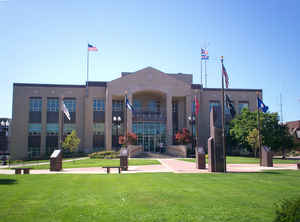
Portage County is a county located in the state of Ohio. Based on the 2010 census, the population was 161,419. Its county seat is
Ravenna. The county was created in 1807 and organized in 1808 and is named for the portage between the Cuyahoga and Tuscarawas Rivers.
Portage County is part of the Akron Metropolitan Statistical Area, which is also included in the Cleveland-Akron-Canton Combined Statistical
Area.
Etymology - Origin of Portage County Name
The county was named for the Indian portage between the Cuyahoga and the Tuscarawas Rivers.
Demographics:
County QuickFacts: CensusBureau Quick Facts
Portage County History
On February 10, 1807, the Ohio government authorized the creation of Portage County. It originally was a portion of the Connecticut Western Reserve. The county was named for the Indian portage between the Cuyahoga and the Tuscarawas Rivers.
Portage County is located in northeastern Ohio and covers 492 square miles. The county has grown in recent years, as residents of nearby Cleveland in Cuyahoga County have moved to Portage and surrounding counties to escape the busyness of the city. Between 1990 and 2000, Portage County's population
increased by 6.6 percent to a total of 152,061 residents in 2000. Ravenna is the county seat and the fourth largest community in the county, with 11,771 residents in 2000. Kent is the county's largest urban center, with a population of 27,906 people in 2000. Portage County averages 309 residents per
square mile.
Portage County is overwhelmingly rural, with only three percent of the county deemed to be urban, but most residents earn their livings by working in manufacturing, sales, or government positions. Farming ranks a distant fifth. Many residents also work at Hiram College or Kent State University. The
county's average income was 24,146 dollars per person in 1999, with 8.7 percent of the population living in poverty.
Most voters in Portage County claim to be independents, yet in recent years, they have supported Democratic Party candidates at the national level.
United States President James Garfield and abolitionist John Brown rank among Portage County's more notable residents. The county also was the site of the Kent State Riot, which occurred when Ohio National Guard troops opened fire on Vietnam War protestors in 1970.
Sources
Portage County, Ohio History Central, July 24, 2008,
http://www.ohiohistorycentral.org/entry.php?rec=2002&nm=Portage-County
Geography: Land and Water
As reported by the Census Bureau, the county has a total area of 504 square miles (1,310 km2), of which 487 square miles (1,260 km2) is
land and 17 square miles (44 km2) (3.3%) is water.
West Branch State Park is a very large state park in central Portage County, consisting of a large green surrounding the Michael J. Kirwan Dam
and Reservoir. There are a number of smaller state and local parks.
Neighboring Counties
Bordering counties are as follows:
- Geauga County (north)
- Trumbull County (east)
- Mahoning County (southeast)
- Stark County (south)
- Summit County (west)
- Cuyahoga County (northwest corner)
Education
Portage County is home to eleven public school districts.


Click Image to Enlarge
