


Click Image to Enlarge
Oklahoma Counties
There are seventy-seven counties in Oklahoma. Oklahoma originally had seven counties when it was first organized as the Oklahoma Territory. These counties were designated numerically, first through seventh. New counties added after this were designated by letters of the alphabet. The first seven counties were later renamed. The Oklahoma Constitutional Convention named all of the counties that were formed when Oklahoma entered statehood in 1907. Only two counties have been formed since thenAtoka County, Oklahoma
Atoka County Education, Geography, and History
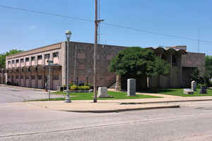
Atoka County is a county located in the state of Oklahoma. Based on the 2010 census, the population was 14,007. Its county seat is Atoka. The county was formed before statehood from Choctaw Lands, and its name honors a Choctaw Chief named Atoka.
Etymology - Origin of Atoka County Name
Named for its county seat which in turn was named for a noted Choctaw sub-chief.
Demographics:
County QuickFacts: CensusBureau Quick Facts
Atoka County History
The area encompassed by the present Atoka County was originally part of Shappaway County in the Pushmataha District of
the Choctaw Nation. About 1854, the area was formally designated Atoka County. The name, which honored Choctaw Chief Atoka, a leader of a
party which migrated from Georgia to Indian Territory, was retained when Oklahoma became a state.
In 1858, the Butterfield and Overland established a stage route through the area. One station, Waddell's was near Wesley, a second station,
Geary's was between Waddell's and the Muddy Boggy River, while a third was at Boggy Depot.
During the Civil War, Confederate troops established a supply depot named Camp Boggy Depot. After the war, the town of Atoka was established.
In 1872, the Missouri-Kansas-Texas Railway (nicknamed the Katy) built a track through the county. It bypassed Boggy Depot and passed through
Atoka, increasing the importance of Atoka and contributing to the decline of Boggy Depot
Oklahoma History Center
Located in the southeastern corner of Oklahoma, Atoka County is bordered by Bryan, Choctaw, Pushmataha, Coal,
Pittsburg, and Johnston counties. In the early nineteenth century the Atoka area existed as part of Shappaway County, in
the Pushmataha District of the Choctaw Nation. The designation as Atoka County came circa 1854 and was retained after
1907 statehood. The county and county seat name honors a noted Choctaw warrior, Captain Atoka, who led a removal party
to present Oklahoma. He lived east of the town that bears his name. The incorporated towns are Atoka (the county seat),
Caney, Stringtown, and Tushka...ATOKA
COUNTY
Geography: Land and Water
As reported by the Census Bureau, the county has a total area of 990 square miles (2,600 km2), of which 976 square miles
(2,530 km2) is land and 14 square miles (36 km2) (1.5%) is water.
Atoka County is drained by North Boggy, Clear Boggy and Muddy Boggy Creeks, which are tributaries of the Red River. Atoka Reservoir is in the
northern section of the county. The Ouachita Mountains are in the eastern part of the county, while the Sandstone Hills and Coastal Plains
physiographic regions provide a more level terrain suitable for agriculture in the north and western part of the county.
Neighboring Counties
Bordering counties are as follows:
- Pittsburg County (north)
- Pushmataha County (east)
- Choctaw County (southeast)
- Bryan County (south)
- Johnston County (west)
- Coal County (northwest)
Education


Click Image to Enlarge
