


Click Image to Enlarge
Oklahoma Counties
There are seventy-seven counties in Oklahoma. Oklahoma originally had seven counties when it was first organized as the Oklahoma Territory. These counties were designated numerically, first through seventh. New counties added after this were designated by letters of the alphabet. The first seven counties were later renamed. The Oklahoma Constitutional Convention named all of the counties that were formed when Oklahoma entered statehood in 1907. Only two counties have been formed since thenBeaver County, Oklahoma
Beaver County Education, Geography, and History
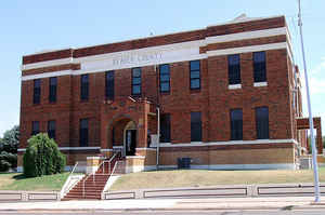
Beaver County is a county located in the state of Oklahoma. Based on the 2010 census, the population was 5,636. The county seat is Beaver. The name was given because of the presence of many beaver dams on the Beaver River, which runs through the area. It is located in the Oklahoma Panhandle.
Etymology - Origin of Beaver County Name
Named for the town which is its county seat and its principal stream, which in turn, was the English translation of the Spanish word "nutria" which was given to this stream because of the numerous beaver dams on the small streams which are tributary to it.
Demographics:
County QuickFacts: CensusBureau Quick Facts
Beaver County History
The land where Beaver County is located has been under several jurisdictions. At one time, it was part of Texas before Texas became a state of the United States. Then in the Compromise of 1850, Texas ceded the land that would eventually become the Oklahoma panhandle to the United States government. The area was known as "No Man's Land" because it belonged to no state or territorial government. There was a period of time (1886 - 1890) that it was a separate organized territory, known as Cimarron Territory. After becoming part of the Oklahoma Territory in 1890, Beaver County (first called Seventh County) covered the entire Oklahoma Panhandle. At statehood in 1907, Cimarron County was taken from the western one-third, while Texas County was taken from the middle, leaving Beaver County only in the east.
Oklahoma History Center
Beaver County lies in Oklahoma Panhandle, a part of the Great Plains proper. It is one of only a few Oklahoma
counties in that physiographic region. Kansas borders Beaver County on the north, and Texas on the south; Texas County
abuts it on the west, and Harper and Ellis on the east. The concept of Beaver County did not come about until the
formation of Cimarron Territory in 1886. That organization included all of No Man's Land, now the present three counties
in the Panhandle. However, there were settlements in the area long before that time....BEAVER
COUNTY
Geography: Land and Water
As reported by the Census Bureau, the county has a total area of 1,818 square miles (4,710 km2), of which 1,815 square miles (4,700 km2) is land and 2.8 square miles (7.3 km2) (0.2%) is water. It is the fifth-largest county in Oklahoma by area.
Neighboring Counties
Bordering counties are as follows:
- Meade County, Kansas (north)
- Clark County, Kansas (northeast)
- Harper County (east)
- Ellis County (southeast)
- Lipscomb County, Texas (south)
- Ochiltree County, Texas (southwest)
- Texas County (west)
- Seward County, Kansas (northwest)
Education


Click Image to Enlarge
