


Click Image to Enlarge
Oklahoma Counties
There are seventy-seven counties in Oklahoma. Oklahoma originally had seven counties when it was first organized as the Oklahoma Territory. These counties were designated numerically, first through seventh. New counties added after this were designated by letters of the alphabet. The first seven counties were later renamed. The Oklahoma Constitutional Convention named all of the counties that were formed when Oklahoma entered statehood in 1907. Only two counties have been formed since thenCoal County, Oklahoma
Coal County Education, Geography, and History
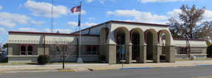
Coal County is a county located in the state of Oklahoma. Based on the 2010 census, the population was 5,925. Its county seat is Coalgate.
Etymology - Origin of Coal County Name
Named for the county seat, Coalgate, and incidentally from the large coal deposits which underlie much of the county.
Demographics:
County QuickFacts: CensusBureau Quick Facts
Coal County History
Coal County was formed at statehood from the former Shappaway County (later renamed Atoka County) of the Pushmataha District of the Choctaw Nation in Indian Territory. A 3.5 miles (5.6 km) strip of Coal County was taken from the Pontotoc District of the Chickasaw Nation. Initially, the Oklahoma legislature named Lehigh as the county seat, but a special election held in 1908 resulted in the citizens choosing Coalgate as the county seat. Lehigh tried to sue, because more people voted than were registered, but no court would hear the case.
Oklahoma History Center
Situated in southeastern Oklahoma, Coal County is bordered by Hughes County on the north, Pittsburg County on the
northeast, Atoka County on the southeast, Johnston County on the southwest, and Pontotoc County on the northwest. At the
turn of the twenty-first century incorporated towns included Centrahoma, Lehigh, Phillips, Tupelo, and Coalgate, the
county seat. The Clear Boggy and Muddy Boggy rivers (creeks) drain the county, which has a total land and water area of
521.3 square miles. Generally, the county has forest in the east, where the foothills of the Ouachita Mountains begin,
and open prairie in the west, and lies generally in the Sandstone Hills physiographic region. Coal County lies within a
region that has been little studied by archaeologists. However, a 1983 published archaeological survey report indicates
that the county has sixty-three known sites, none of which have been tested....COAL
COUNTY
Geography: Land and Water
As reported by the Census Bureau, the county has a total area of 521 square miles (1,350 km2), of which 517 square miles
(1,340 km2) is land and 4.7 square miles (12 km2) (0.9%) is water.
It is the fifth-smallest county in Oklahoma by area. The eastern part of the county lies in the Ouachita Mountains, while the western part has
open prairie and lies in the Sandstone Hills physiographic region. The county is drained by the Clear Boggy and Muddy Boggy creeks
Neighboring Counties
Bordering counties are as follows:
- Hughes County (north)
- Pittsburg County (northeast)
- Atoka County (southeast)
- Johnston County (southwest)
- Pontotoc County (west)
Education


Click Image to Enlarge
