


Click Image to Enlarge
Oklahoma Counties
There are seventy-seven counties in Oklahoma. Oklahoma originally had seven counties when it was first organized as the Oklahoma Territory. These counties were designated numerically, first through seventh. New counties added after this were designated by letters of the alphabet. The first seven counties were later renamed. The Oklahoma Constitutional Convention named all of the counties that were formed when Oklahoma entered statehood in 1907. Only two counties have been formed since thenGreer County, Oklahoma
Greer County Education, Geography, and History
Greer County is a county located along the southwest border of the state of Oklahoma. Based on the 2010 census, the population was 6,239. Its county seat is Mangum. From 1860 to 1896, the state of Texas claimed an area known as Greer County, Texas, which included present-day Greer County along with neighboring areas. In 1896 it was designated as a county in Oklahoma Territory under a ruling by the US Supreme Court.
Etymology - Origin of Greer County Name
was so named in 1860 by the legislature of the state of Texas in honor of Lieutenant Governor John A. Greer of that state. It was claimed as a part of the dominions of Texas until 1895 when the U. S. Supreme Court decided that it was not a part of Texas, after which it was annexed to the territory of Oklahoma.
Demographics:
County QuickFacts: CensusBureau Quick Facts
Greer County History
After a dispute over the 1819 Adams-Onís Treaty and the related 1828 Treaty of Limits, the governments of both the
United States and the state of Texas claimed ownership of some 1.5 million acres (6,000 km²) in what was then operated as Greer County, Texas.
The county was named for former Texas lieutenant governor, John A. Greer. Litigation followed, and in the case of United States v. State of
Texas 162 US 1 (1896), with a ruling issued on March 16, the Supreme Court, having original jurisdiction over the case, decided in favor of
the United States.
The county was assigned to the Oklahoma Territory on May 4, 1896. When Oklahoma was admitted as a state, Greer County was established
according to its current boundaries; the remaining former county area was organized as Harmon, Jackson, and part of Beckham counties. The town
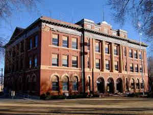
of Mangum, designated as the county seat in 1886 when this was part of Texas, continued as the seat of Greer County, Oklahoma.
OLD GREER COUNTY
Oklahoma History Center
The Greer County dispute between Texas and the United States began as a result of the Adams-On? Treaty of 1819
between the United States and Spain, defining the border between the United States and Spanish territory in North
America. Article III of the treaty described part of the boundary as following the Red River west to the 100th
meridian and then north to the Arkansas River. At the time of the treaty the upper sources of the Red River had not
been mapped. The treaty used a map published in Philadelphia in 1818, known as the Melish Map, to establish the
territorial boundaries. The Melish Map was based on secondary sources and showed the Red River as a single channel.
The fourth article of the treaty provided for a more accurate location and marking of the boundary line, but this
article was not acted on at the time...OLD
GREER COUNTY
GREER COUNTY
Oklahoma History Center
Located in southwestern Oklahoma, Greer County is bounded by Beckham County on the north, Kiowa County on the
east, Jackson County on the south, and Harmon County on the west. Organized from Old Greer County at 1907
statehood, Greer County is named for former Texas Lt. Governor John A. Greer. Mangum is the county seat. The western
two-thirds of the county lies in the Gypsum Hills, while the eastern one-third is in the Red Bed Plains
physiographic region. The county's boundaries have changed several times. In 1909 Harmon County was formed from the
western part of Greer, and in 1910 a southern portion of Beckham County was annexed back to Greer. With 643.66
square miles in land and water, Greer County is drained by the North Fork, Elm Fork, and Salt Fork of the Red
River....GREER COUNTY
Geography: Land and Water
As reported by the Census Bureau, the county has a total area of 644 square miles (1,670 km2), of which 639 square miles
(1,660 km2) is land and 4.3 square miles (11 km2) (0.7%) is water.
Western Greer County lies in the Gypsum Hills, while the eastern one-third is in the Red Bed Plains physiographic region. The county is
drained by the North Fork Red River, Elm Fork Red River, and Salt Fork Red River.
Neighboring Counties
Bordering counties are as follows:
- Beckham County (north)
- Kiowa County (east)
- Jackson County (south)
- Harmon County (west)
Education


Click Image to Enlarge
