


Click Image to Enlarge
Oklahoma Counties
There are seventy-seven counties in Oklahoma. Oklahoma originally had seven counties when it was first organized as the Oklahoma Territory. These counties were designated numerically, first through seventh. New counties added after this were designated by letters of the alphabet. The first seven counties were later renamed. The Oklahoma Constitutional Convention named all of the counties that were formed when Oklahoma entered statehood in 1907. Only two counties have been formed since thenHarper County, Oklahoma
Harper County Education, Geography, and History
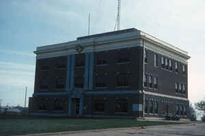
Harper County is a county located in the state of Oklahoma. Based on the 2010 census, the population was 3,685, making it the fifth-least populous county in Oklahoma. The county seat is Buffalo. It was created in 1907 from the northwestern part of Woodward County, and named for Oscar Green Harper, who was clerk of the Oklahoma Constitutional Convention
Etymology - Origin of Harper County Name
Named for O. G. Harper, a clerk in the Constitutional Convention.
Demographics:
County QuickFacts: CensusBureau Quick Facts
Harper County History
During the late 19th Century, the area now known as Harper County was part of the Cherokee Outlet, reserved for use
by the Cherokee Nation by treaties in 1828 and 1835, The US government opened the outlet for settlement by non-Indians in 1893. The area was
divided into counties after the formation of what is now the state of Oklahoma. Harper County was created in 1907. It was named for Oscar
Green Harper, who was a local resident, school teacher, and served as clerk of the Oklahoma Constitutional Convention.
The present county lay on several trails that were blazed during the 19th Century. One of the most significant was the Fort Dodge to Camp
Supply Military Trail. It was used followed in 1868 by the US Army's Seventh Cavalry, to move men and supplies to build Camp Supply
(forerunner of the present town of Fort Supply, Oklahoma). The Great Western Trail (also known as the Dodge City Trail) was first used between
South Texas and Fort Robinson, Nebraska, in 1874. The Cimarron Valley Turnpike Company built a bridge over the Cimarron River in 1908 to
facilitate travel between Englewood, Kansas and Oklahoma.
A 1908 election was held to determine whether Buffalo or Doby Springs would become the county seat. Buffalo won the election. Doby Springs
later ceased to be a town and is now a park in Buffalo. Other ghost towns in the county are Paruna, Flat, Avis, Readout, Cross, Alto, Cupid,
and Stockholm.
Oklahoma History Center
The parcel of Oklahoma land now called Harper County began with the Cherokee Outlet Opening in 1893; the county
itself came from the northwest section of Woodward County in 1907. It is now surrounded on the north by Clark and
Comanche counties in Kansas, Woodward and Woods counties on the east, Beaver County on the west, and Woodward and Ellis
counties to the south. In 1907 the population reached 8,089 and peaked with 8,189 in 1910
The area was once a part of the Cherokee Outlet, set aside for that nation in treaties of 1828 and 1835. The
Outlet was opened for non-Indian settlement in September 1893. Created at 1907 statehood and named for a local
pioneer resident, teacher, and clerk of the Oklahoma Constitutional Convention of 1906, Oscar Greene Harper from
Missouri, Harper County encompasses a total land and water area of 1,040.9 square miles. Two rivers flow through the
landscape of rocky, red canyons in the east and high plains and rolling hills in the west: the Cimarron and the
Beaver (North Canadian). Dolby Springs Park, replete with a golf course and an artesian well, rests ten miles
northwest of Buffalo, the county seat. The county produces wheat, cattle, petroleum, natural gas, and gypsum.
Early-day residents supplemented their farming and ranching livelihoods by selling dry bison bones. Sinclair Prairie
Oil Company drilled the county's discovery well in 1930. Presently, education, oil and gas, and government services
employ the majority of workers...HARPER
COUNTY
Geography: Land and Water
As reported by the Census Bureau, the county has a total area of 1,041 square miles (2,700 km2), of which 1,039 square miles
(2,690 km2) is land and 2.0 square miles (5.2 km2) (0.2%) is water.
The county is drained by the Cimarron River and the North Canadian River.
Neighboring Counties
Bordering counties are as follows:
- Comanche County, Kansas (northeast)
- Woods County (east)
- Woodward County (southeast)
- Ellis County (south)
- Beaver County (west)
- Clark County, Kansas (northwest)
Education


Click Image to Enlarge
