


Click Image to Enlarge
Oklahoma Counties
There are seventy-seven counties in Oklahoma. Oklahoma originally had seven counties when it was first organized as the Oklahoma Territory. These counties were designated numerically, first through seventh. New counties added after this were designated by letters of the alphabet. The first seven counties were later renamed. The Oklahoma Constitutional Convention named all of the counties that were formed when Oklahoma entered statehood in 1907. Only two counties have been formed since thenLatimer County, Oklahoma
Latimer County Education, Geography, and History
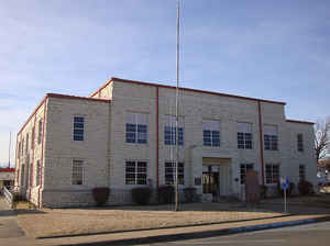
Latimer County is a county located in the southeastern part of the state of Oklahoma. Its county seat is Wilburton. Based on the 2010 census, the population was 11,154. The county was created at statehood in 1907 and named for James L. Latimer, a delegate from Wilburton to the 1906 Constitutional Convention. Prior to statehood, it had been part of Gaines County, Choctaw Nation.
Etymology - Origin of Latimer County Name
Named for J. S. Latimer, member of the Constitutional Convention.
Demographics:
County QuickFacts: CensusBureau Quick Facts
Latimer County History
In 1831, the area now known as Latimer County became a part of Gaines County in the Choctaw Nation in the Indian Territory in 1831. The county seat was then at Gaines Courthouse. In 1858, the Butterfield Overland Mail established a route through the territory, which included stage stops at Edwards's Station (near present Hughes), Holloway's Station (near Red Oak), Riddle's Station (near Lutie) and Pusley's Station near Higgins.
Oklahoma History Center
Located in southeastern Oklahoma, Latimer County encompasses 729.12 square miles of total land and water area.
Bordering counties are Le Flore on the east, Haskell on the north, Pittsburg on the west, and Pushmataha on the south.
With a 1907 population of 9,340, the county was created at Oklahoma statehood and named for James L. Latimer, the
Wilburton-area representative in the 1906 Constitutional Convention. Wilburton serves as county seat, and Red Oak is the
only other incorporated town.
The countryside is hilly and forested, with the Sans Bois Mountains spanning the northern edge of the county and the
western ridges of the Winding Stair Mountains extending into the southern region. Rich coal deposits have been an
important economic resource. Fourche Maline, Brazil, and Sans Bois creeks drain the northern part of the county into the
Poteau River; Buffalo and Gaines creeks drain the southern part into the Kiamichi River. In neighboring Pushmataha
County, Jackfork Creek is dammed to create Sardis Lake, some of which extends into southwestern Latimer County....LATIMER
COUNTY
Geography: Land and Water
As reported by the Census Bureau, the county has a total area of 729 square miles (1,890 km2), of which 722 square miles
(1,870 km2) is land and 7.0 square miles (18 km2) (1.0%) is water.
The Sans Bois Mountains span the northern border of the county, while the Winding Stair Mountains extend into its southern part. The Fourche
Maline, Brazil and Sans Bois creeks drain the northern part of the county into the Poteau River, a tributary of the Arkansas River. Buffalo
and Gaines Creeks drain the southern part into the Kiamichi River, a tributary of the Red River.
Neighboring Counties
Bordering counties are as follows:
- Haskell County (north)
- Le Flore County (east)
- Pushmataha County (south)
- Pittsburg County (west)
Education
In 1909 state government created the Oklahoma School of Mines and Metallurgy at Wilburton, placed centrally within the southeastern Oklahoma mining district. In 2000, as Eastern Oklahoma State College, the school was a two-year, liberal-arts institution.


Click Image to Enlarge
