


Click Image to Enlarge
Oklahoma Counties
There are seventy-seven counties in Oklahoma. Oklahoma originally had seven counties when it was first organized as the Oklahoma Territory. These counties were designated numerically, first through seventh. New counties added after this were designated by letters of the alphabet. The first seven counties were later renamed. The Oklahoma Constitutional Convention named all of the counties that were formed when Oklahoma entered statehood in 1907. Only two counties have been formed since thenMarshall County, Oklahoma
Marshall County Education, Geography, and History
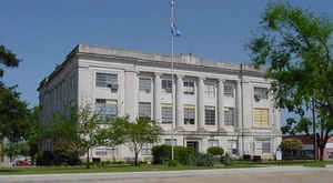
Marshall County is a county located on the south central border of Oklahoma. Based on the 2010 census, the population was 15,840. Its county seat is Madill. The county was created at statehood in 1907 from the former Pickens County of the Chickasaw Nation. It was named to honor the maiden name of the mother of George Henshaw, a member of the 1906 Oklahoma Constitutional Convention. The county and it's cities are part of the Texoma region.
Etymology - Origin of Marshall County Name
Named in honor of the mother of George A. Henshaw, delegate to the Constitutional Convention. that having been her maiden name.
Demographics:
County QuickFacts: CensusBureau Quick Facts
Marshall County History
The area covered by Marshall County was part of the territory set aside by the US government for resettlement of the Choctaw tribe and the closely related Chickasaw tribe from their lands in the southeastern United States. The Chickasaws began relocating to this area in 1837. The US Army built Fort Washita in 1842 to protect the new arrivals from raids by other tribes. In 1857, the Chickasaw Nation formally separated from the Choctaw Nation. This area became part of Pickens County in the Chickasaw Nation.
Oklahoma History Center
Created at 1907 statehood Marshall County is in south-central Oklahoma, with Johnston County on its north, Bryan on
the east, Love and Carter on the west, and the state of Texas on the south. The county name honors the maiden name of
George Henshaw's mother. Henshaw, a Madill native, served in the 1906 Oklahoma Constitutional Convention. The county
contains 426.95 square miles of land and water area. The incorporated towns are Kingston, Madill (the county seat), and
Oakland.
The county lies in the Coastal Plain physiographic region, accounting for its rolling prairies. There are also
intermittent deposits of limestone. The Red River Basin drains the county. In 1944 the US Army Corps of Engineers
completed the Denison Dam, impounding the Red and Washita rivers, creating Lake Texoma, and inundating a large amount of
Marshall County's land. The lake not only forms the county's southern border, but it also comprises the eastern border,
which had been the Washita River....MARSHALL
COUNTY
Geography: Land and Water
As reported by the Census Bureau, the county has a total area of 427 square miles (1,110 km2), of which 371 square miles (960 km2) is land and 56 square miles (150 km2) (13%) is water. It is the smallest county in Oklahoma by land area and the third-smallest by total area. The Red River drains the county and formed the county's southern boundary. Completion of the Denison Dam in 1942 created Lake Texoma which inundated part of Marshall County's land area and forms the current southern boundary and the eastern boundary of the county as well.
Neighboring Counties
Bordering counties are as follows:
- Johnston County (north)
- Bryan County (east)
- Grayson County, Texas (south)
- Love County (west)
- Carter County (northwest)
Education


Click Image to Enlarge
