


Click Image to Enlarge
Oklahoma Counties
There are seventy-seven counties in Oklahoma. Oklahoma originally had seven counties when it was first organized as the Oklahoma Territory. These counties were designated numerically, first through seventh. New counties added after this were designated by letters of the alphabet. The first seven counties were later renamed. The Oklahoma Constitutional Convention named all of the counties that were formed when Oklahoma entered statehood in 1907. Only two counties have been formed since thenMcClain County, Oklahoma
McClain County Education, Geography, and History
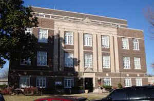
McClain County is a county located in south central Oklahoma. Based on the 2010 census, the population was 34,506. Its county seat is Purcell.
The county was named for Charles M. McClain, an Oklahoma constitutional convention attendee.
McClain County is part of the Oklahoma City, OK Metropolitan Statistical Area.
Etymology - Origin of McClain County Name
Named for Charles McClain, member of the Constitutional Convention.
Demographics:
County QuickFacts: CensusBureau Quick Facts
McClain County History
The Chickasaw tribe began moving into this area in 1837, when the land had already been assigned to the Choctaws by the US government. In 1855, the area became part of the Chickasaw Nation, after the two tribes officially separated. The present McClain County became part of Pontotoc County, Chickasaw Nation and remained such until Oklahoma attained statehood. Few Chickasaws lived here because of hostilities with western tribes (e.g., Kiowa). Major Richard Mason established Camp Holmes (also called Camp Mason) in 1835, near the present city of Lexington, while negotiating a treaty between the western tribes and the newly arrived Choctaws. Federal troops abandoned the camp in August 1835, after the Treaty of Camp Holmes was signed.
Oklahoma History Center
Located in central Oklahoma, McClain County, created at 1907 statehood, incorporates 580.13 square miles of land and
water. The name honors Charles M. McClain, a member of Oklahoma's 1906 Constitutional Convention. Cleveland County and a
portion of Pottawatomie County border McClain County on the north, with Pontotoc on the east, Garvin on the south, and
Grady on the west. At the end of the twentieth century incorporated towns included Blanchard, Byars, Cole, Dibble,
Goldsby, Newcastle, Rosedale, Washington, Wayne, and Purcell served as the county seat.
The county lies in the Redbed Plains region of the broader Osage Plains. The western portion is hilly and historically
has been blanketed with black jack oak trees. Level lowlands characterize the southeastern arm. The South Canadian River
forms the northern border, draining much of the county. The Washita River flows near the southwestern corner, with
several McClain County creeks feeding it....McCLAIN
COUNTY
Geography: Land and Water
As reported by the Census Bureau, the county has a total area of 580 square miles (1,500 km2), of which 571 square miles
(1,480 km2) is land and 9.6 square miles (25 km2) (1.6%) is water.
The county lies largely in the Red Bed Plains region of the Osage Plains. The western part of the county is hilly and covered with black jack
oak trees, while the eastern part is level lowlands. The South Canadian River forms the northern border, The Washita River flows through the
southwestern corner, and is fed by several McClain County creeks.
Neighboring Counties
Bordering counties are as follows:
- Cleveland County (north)
- Pottawatomie County (northeast)
- Pontotoc County (east)
- Garvin County (south)
- Grady County (west)
Education


Click Image to Enlarge
