


Click Image to Enlarge
Oklahoma Counties
There are seventy-seven counties in Oklahoma. Oklahoma originally had seven counties when it was first organized as the Oklahoma Territory. These counties were designated numerically, first through seventh. New counties added after this were designated by letters of the alphabet. The first seven counties were later renamed. The Oklahoma Constitutional Convention named all of the counties that were formed when Oklahoma entered statehood in 1907. Only two counties have been formed since thenNowata County, Oklahoma
Nowata County Education, Geography, and History
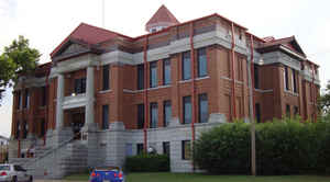
Nowata County is a county located in northeastern Oklahoma. Based on the 2010 census, the population was 10,536. Its county seat is Nowata. The county name is derived from a Delaware word "no-we-ata," meaning "come here" or "welcome." It is located on the Kansas border.
Etymology - Origin of Nowata County Name
Named for its county seat town. The name is said to be a corruption of the Delaware Indian word "Noweeta" meaning "welcome."
Demographics:
County QuickFacts: CensusBureau Quick Facts
Nowata County History
For millennia, the land now known as Oklahoma was inhabited by Native Americans. The Encyclopedia of Oklahoma History
and Culture states that archaeological evidence indicates that humans first lived in this area in the Verdigris River valley over six thousand
years ago. In the 17th century, white trappers first visiting the area found it occupied mostly by the Osage and Quapaw tribes. It was
recognized as Osage territory by the time United States secured it as part of the Louisiana Purchase in 1803. In 1819, the Arkansas Territory
was organized, then was split in 1824 and 1828. An 1828 treaty with the Cherokee Nation assigned the area of Nowata County to the Cherokees,
who included it in 1856 in their newly created Cooweescoowee District. The Cherokees and the Delaware signed a treaty in 1867 that resulted in
Delaware settlements near the present towns of Delaware, Lenapah and Nowata, Oklahoma.
The state of Oklahoma and Nowata County was established in 1907, and the county had a population of 10,453. The town of Nowata was named as
county seat. The exact origin is unknown, but the two most common stories are that railroad surveyors used the Delaware word noweta for
welcome or that a sign was posted indicating that local springs had no water: No wata.
Oklahoma History Center
Nowata County is located in northeastern Oklahoma. Surrounding Oklahoma counties include Craig on the east, Rogers on
the south, and Washington on the west. The Kansas counties of Montgomery and Labette border on the north. Archaeologists
believe humans first occupied Nowata County some six centuries ago. Among the first inhabitants were prehistoric
American Indians called the "Earth House People" and the "Cave and Ledge People." Three archaeological excavations, the
Craig, Lawrence, and Lightning Creek sites, revealed much information about those people. Located in the Verdigris River
valley, the sites date from between 1000 to 1500 B.C....NOWATA
COUNTY
Geography: Land and Water
As reported by the Census Bureau, the county has a total area of 581 square miles (1,500 km2), of which 566 square miles
(1,470 km2) is land and 15 square miles (39 km2) (2.6%) is water.
The Verdigris River divides the county into eastern and western halves. Creeks in the extreme western part of the county drain into the Caney
River. All other creeks drain into the Verdigris River. Lake Oologah lies partly in this county.
Neighboring Counties
Bordering counties are as follows:
- Montgomery County, Kansas (north)
- Labette County, Kansas (northeast)
- Craig County (east)
- Rogers County (south)
- Washington County (west)
Education


Click Image to Enlarge
