


Click Image to Enlarge
Oklahoma Counties
There are seventy-seven counties in Oklahoma. Oklahoma originally had seven counties when it was first organized as the Oklahoma Territory. These counties were designated numerically, first through seventh. New counties added after this were designated by letters of the alphabet. The first seven counties were later renamed. The Oklahoma Constitutional Convention named all of the counties that were formed when Oklahoma entered statehood in 1907. Only two counties have been formed since thenPontotoc County, Oklahoma
Pontotoc County Education, Geography, and History
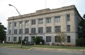
Pontotoc County is in the south central part of Oklahoma. Based on the 2010 census, the population was 37,492. Its county seat is Ada. The county
was created at statehood from part of the Chickasaw Nation in Indian Territory. It was named for a historic Chickasaw tribal area in
Mississippi. According to the Encyclopedia of Oklahoma History and Culture, Pontotoc is usually translated "cattail prairie" or "land of
hanging grapes."
Pontotoc County comprises the Ada, OK Micropolitan Statistical Area.
Etymology - Origin of Pontotoc County Name
the name of one of the counties of the Chickasaw Nation, which, in turn, had been named for Pontotoc Creek in the old Chickasaw country, in Mississippi.
Demographics:
County QuickFacts: CensusBureau Quick Facts
Pontotoc County History
The present Pontotoc County was part of the land that the U. S. government granted in 1830 to the Choctaw tribe via
the Treaty of Dancing Rabbit Creek. In 1837, the Chickasaw tribe was granted land within the Choctaw domain. In 1857, the Chickasaw Nation
formed its own government on this land. However, few Chickasaw settled there until after the Civil War, mainly because of attacks by various
Plains Indian tribes.
The first settlers located in the vicinity of Boggy Depot during the 1840s. Camp Arbuckle was established to protect migrants traveling on the
California Road. After the Civil War, settlements began spreading through the area. Some of the new settlers were illegal white intruders and
outlaws. The first post office was established at Stonewall in 1878. The town of Ada was founded in 1890. After three railroads built
linesthrough Ada, it became the dominant community of the area. Ada was named county seat when Pontotoc County was created.
Oklahoma History Center
Pontotoc County is located in south-central Oklahoma, just east of a line dividing the state into its eastern and
western segments. Surrounding counties include Seminole, Hughes, Coal, Johnston, Murray, Garvin, McClain, and
Pottawatomie. The northern boundary is also marked by the Canadian River. The county incorporates 725.4 square miles of
land and water area. Created at 1907 statehood, it took its name from a historic Chickasaw tribal area in Mississippi,
which is also mirrored by a county name in that state. The 1832 Treaty of Pontotoc Creek provided for removal of the
Chickasaw to Indian Territory. Pontotoc is usually translated "cattail prairie" or "land of hanging grapes."...PONTOTOC
COUNTY
Geography: Land and Water
As reported by the Census Bureau, the county has a total area of 725 square miles (1,880 km2), of which 720 square miles (1,900 km2) is land and 4.8 square miles (12 km2) (0.7%) is water. The Canadian River forms the northern boundary.
Neighboring Counties
Bordering counties are as follows:
- Seminole County (north)
- Hughes County (northeast)
- Coal County (southeast)
- Johnston County (south)
- Murray County (southwest)
- Garvin County (west)
- McClain County (northwest)
- Pottawatomie County (northwest)
Education


Click Image to Enlarge
