Oklahoma Counties
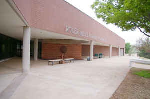
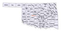
There are seventy-seven counties in Oklahoma. Oklahoma originally had seven counties when it was first organized as the Oklahoma Territory. These counties were designated numerically, first through seventh. New counties added after this were designated by letters of the alphabet. The first seven counties were later renamed. The Oklahoma Constitutional Convention named all of the counties that were formed when Oklahoma entered statehood in 1907. Only two counties have been formed since thenRoger Mills County, Oklahoma
Roger Mills County Education, Geography, and History

Roger Mills County is a county located in the western part of the state of Oklahoma. Based on the 2010 census, the population was 3,647,
making it the third-least populous county in Oklahoma. Its county seat is Cheyenne. The county was created in 1891.
The county is located above the petroleum-rich Anadarko Basin
Etymology - Origin of Roger Mills County Name
Named by vote of the people of the county, most of whom were recent emigrants from Texas, of which state Roger Q. Mills was then U. S. senator.
Demographics:
County QuickFacts: CensusBureau Quick Facts
Roger Mills County History
Roger Mills County takes its name from Roger Q. Mills, a senator from Texas. The town of Cheyenne in Roger Mills
County is the location of the Battle of Washita River (also called Battle of the Washita; Washita Battlefield and the Washita Massacre), where
George Armstrong Custer's 7th US Cavalry attacked Chief Black Kettle's Cheyenne village on the Washita River on November 26, 1868.
The area covered by Roger Mills County had been part of the Cheyenne Arapaho reservation until after Oklahoma Territory was created and County
E was formed. County E was renamed Day County. Day County was abolished and Roger Mills County was created at statehood on November 16, 1907.
The county's western boundary with Texas was moved eastward 3,800 feet (1,200 m) when the Supreme Court ruled that the 100th Meridian was
farther east than originally supposed.
Oklahoma History Center
Located in western Oklahoma, Roger Mills County is bounded by Ellis County on the north, Dewey and Custer counties on
the east, Beckham County on the south, and the state of Texas on the west. Named for Texas politician Roger Quarles
Mills, most of the county lies within the High Plains physiographical region, and the southeastern corner is in the
Gypsum Hills region. The Washita and Canadian rivers drain the county. The Antelope Hills (listed in the National
Register of Historic Places, NR 78002259) are located in a bend of the Canadian River in northwestern Roger Mills
County. The county sits atop the petroleum-rich Anadarko Basin. Incorporated towns at the turn of the twenty-first
century included Cheyenne, the county seat, Hammon, Reydon, and Strong City.
Present Roger Mills County was originally part of the Cheyenne and Arapaho Reservation. Before the area was opened for
non-Indian settlers on April 19, 1892, Counties C through H were created. E County became Day County, and F County
became Roger Mills. At 1907 statehood the boundaries of Roger Mills County changed. The southern portion of former Day
County was added to Roger Mills, and the southern portion of Roger Mills was added to Beckham County. On March 17, 1930,
Roger Mills' western boundary was changed after the US Supreme Court ruled that the true 100th Meridian was actually
thirty-eight hundred feet further east. Roger Mills County came to comprise 1,146.46 square miles of land and water...ROGER
MILLS COUNTY
Geography: Land and Water
As reported by the Census Bureau, the county has a total area of 1,146 square miles (2,970 km2), of which 1,141 square miles (2,960 km2) is land and 5.3 square miles (14 km2) (0.5%) is water. The Canadian River forms the northern border of the county. The Washita River passes by Cheyenne and Strong City as it crosses the county from west to east.
Neighboring Counties
Bordering counties are as follows:
- Ellis County (north)
- Dewey County (northeast)
- Custer County (east)
- Beckham County (south)
- Wheeler County, Texas (southwest)
- Hemphill County, Texas (northwest)
Education


