


Click Image to Enlarge
Oklahoma Counties
There are seventy-seven counties in Oklahoma. Oklahoma originally had seven counties when it was first organized as the Oklahoma Territory. These counties were designated numerically, first through seventh. New counties added after this were designated by letters of the alphabet. The first seven counties were later renamed. The Oklahoma Constitutional Convention named all of the counties that were formed when Oklahoma entered statehood in 1907. Only two counties have been formed since thenWagoner County, Oklahoma
Wagoner County Education, Geography, and History
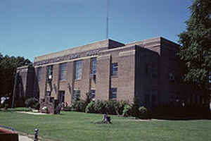
Wagoner County is a county located in the state of Oklahoma. Based on the 2010 census, the population was 73,085. Its county seat is
Wagoner.
Wagoner County is included in the Tulsa, OK Metropolitan Statistical Area.
Etymology - Origin of Wagoner County Name
said to have been named for its county seat, which in turn is said to have been named for Bailey P. Waggoner, attorney of the Missouri Pacific Railway Company at the time of building one of its lines led to the founding of the town.
Demographics:
County QuickFacts: CensusBureau Quick Facts
Wagoner County History
According to archaeological studies, this area was inhabited by Caddoan Mound Builders during the period A.D. 300 to
1200.
The western area of Wagoner County was settled by the Creek after their forced removal in Alabama in the 1820s. The eastern portion of the
county was settled by the Cherokee.
During the Civil War in 1865, the present county was the scene of the Battle of Flat Rock (also known as the Hay Camp Action). Confederate
troops led by Brig. General Stand Watie and Brig. General Richard Gano captured 85 Union troops and killed even more that were harvesting hay.
In 1905, the Sequoyah Convention proposed creating two counties from this area. The western half would be named Coweta and the eastern half
would have been named Tumechichee. However, failure of the attempt to create the state of Sequoyah negated the proposal. In 1907 at Oklahoma
Statehood, Wagoner County was organized. The towns of Porter and Coweta vied with Wagoner as the county seat. The county was named after the
town of Wagoner, which won the election. The town was named after Henry "Bigfoot" Wagoner, a Katy Railroad dispatcher from Parsons, Kansas.
Oklahoma History Center
Located in Oklahoma's northeastern region, Wagoner County was created at 1907 statehood. Surrounding counties include
Rogers and Mayes on the north, Cherokee on the east, Muskogee and Okmulgee on the south, and Tulsa on the west. At the
turn of the twenty-first century incorporated towns included Coweta, New Tulsa, Okay, Porter, Redbird, Tullahassee, and
Wagoner, the county seat....WAGONER
COUNTY
Geography: Land and Water
As reported by the Census Bureau, the county has a total area of 591 square miles (1,530 km2), of which 562 square miles (1,460 km2) is land and 29 square miles (75 km2) (4.9%) is water. It is part of the Ozark Highlands. The Verdigris River divides the east and west parts of the county. The Arkansas River forms part of the western and southern boundaries. Grand River also flows south through the county. It was dammed in 1942 to create Fort Gibson Lake.
Neighboring Counties
Bordering counties are as follows:
- Rogers County (northwest)
- Mayes County (northeast)
- Cherokee County (east)
- Muskogee County (south)
- Tulsa County (west)
Education


Click Image to Enlarge
