


Click Image to Enlarge
Oregon Counties
There are thyirty-six counties in the state of Oregon. The Oregon Constitution does not explicitly provide for county seats.Lake County, Oregon
Lake County Education, Geography, and History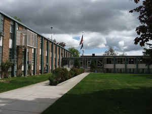
Lake County is a county in the south-central region of the state of Oregon. Based on the 2010 census, the population was 7,895. Its
county seat is Lakeview. The county is named for the many lakes found within its boundaries, including Lake Abert, Summer Lake, Hart Lake,
and Goose Lake.
Lake County is in the high desert region known as the Oregon Outback, on the northwestern edge of the Great Basin. The county is generally
divided between the communities around Lakeview and Paisley to the south and the communities around Christmas Valley, Fort Rock, and Silver
Lake to the north
Etymology - Origin of Lake County Name
Named because of the numerous large lakes that are entirely or partly within its borders.
Demographics:
County QuickFacts: CensusBureau Quick Facts
Lake County History
Lake County was established on
October 24, 1874. It was created from the southern part of Wasco County and the
eastern part of Jackson County. It was named because of the numerous large lakes
that are entirely or partly within its borders.
Lake County is situated in south central Oregon. The western boundary was
changed with the creation of Klamath County in 1882. It regained some area when
the southwestern part of Grant County was annexed in 1885. It currently has
8,275 square miles. Lake County is bounded on the north by Deschutes County, on
the east by Harney County, on the south by the State of California, and on the
west by Klamath County.
When the Legislative Assembly created Lake County, it temporarily located the
county seat at Linkville until the voters selected a permanent site. The voters
chose to move the county seat to Lakeview. Lakeview overlooks Goose Lake; hence
the rationale for the name that John A. Moon proposed and which was adopted at a
meeting in 1876.
The land for the first courthouse was donated by one of the areas first
settlers, M.W. Bullard. The first courthouse was completed in 1904. In 1954 a
new courthouse was built on the site of the former courthouse at a cost of
$366,427.
The government of Lake County consisted originally of a county judge, a county
commissioner, clerk, treasurer, and sheriff. Another commissioner, assessor,
school superintendent, and surveyor were later added. The county court was
abolished and replaced with a board of county commissioners by 1971.
The 1875 Lake County census showed a population of 944, which jumped to 2,804 by
1880. Since then there has been some fluctuation in population, but with a
fairly steady growth to a population of 7,422 in 2000. This represented a 3.28%
increase over the 1990 population.
Because of poor transportation connections with the rest of Oregon, the early
economic orientation of Lake County was toward California. During the 1840s and
1850s the county was part of the military courier route between The Dalles on
the Columbia River and the Presidio in San Francisco. The county did not acquire
a railroad connection until the 1890s.
The traditional county economy rests on lumber, agriculture, and government. In
spite of the low rainfall and a short growing season a combination of
homesteading and irrigation has permitted agriculture based upon the raising of
livestock and the growing of hay and grain to thrive. Lumber and wood products
are taken from the Fremont National Forest. Government employees from the
national forest and the regional BLM headquarters create a more stable economic
base for the county that otherwise would have to rely only on seasonal
agricultural and lumber jobs. Tourism is a growing industry because of the
county's many interesting sites, including Hart Mountain Antelope Refuge,
Hunter's Hot Springs, Goose Lake, and areas for rock hunting and hang gliding.
Geography: Land and Water
As reported by the Census Bureau, the county has a total area of 8,358 square miles (21,650 km2), of which 8,139 square miles (21,080
km2) is land and 219 square miles (570 km2) (2.6%) is water. It is the third-largest county in Oregon.
Lake County ranges in elevation from 4,130 to 8,446 feet (1,259 to 2,574 m). The highest point in Lake County is Crane Mountain. The mountain
is located 6 miles (9.7 km) north of the California border. Lake County has six other peaks with elevations above 8,000 feet (2,400 m), all
located in the southern half of the county. Hager Mountain is the highest peak in the northern part of the county.
Neighboring Counties
Bordering counties are as follows:
- Deschutes County (north)
- Klamath County (west)
- Harney County (east)
- Modoc County, California (south)
- Washoe County, Nevada (south)
Education


Click Image to Enlarge
