


Click Image to Enlarge
Oregon Counties
There are thyirty-six counties in the state of Oregon. The Oregon Constitution does not explicitly provide for county seats.Union County, Oregon
Union County Education, Geography, and History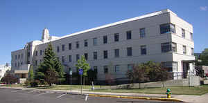
Union County is a county located in the state of Oregon. Based on the 2010 census, the population was 25,748. Its county seat is La Grande.
Union County comprises the La Grande, OR Micropolitan Statistical Area. It is one of the eight counties of eastern Oregon.
Etymology - Origin of Union County Name
Union County's name reflects the support of the people in this area toward maintaining the United States during the Civil War.
Demographics:
County QuickFacts: CensusBureau Quick Facts
Union County History
The population growth in eastern
Oregon during the early 1860s prompted the Legislative Assembly to split
Umatilla and Baker Counties from Wasco County on September 22, 1862. Further
development of the Grande Ronde Valley led to calls for the legislature to split
Union County from Baker County. This finally occurred on October 14, 1864. Union
County's name reflects the support of the people in this area toward maintaining
the United States during the Civil War.
Between 1875 and 1913, adjustments were made to Union County's borders with
Baker, Umatilla, and Wallowa Counties. Union County, lying between the Blue and
Wallowa Mountains, is bordered by Wallowa County on the east and north, Umatilla
County on the west, and Grant and Baker Counties on the south.
The establishment of a county seat resulted in competition, based on geography
and on economic and population growth, between La Grande and the city of Union.
The county seat moved between Union and La Grande until it was permanently
transferred to La Grande in 1905.
With each transfer of the county seat, there was a similar removal of the county
courthouse. The first courthouses were rented structures in Union and La Grande.
When the city of Union was designated as the county seat in 1874, the county's
records were quickly moved to a new brick courthouse in the area where Union
High School now stands. La Grande regained the county seat in 1905 and moved
into the courthouse that had been built the previous year as the city hall. The
courthouse was razed in 1996 and offices for the county clerk, assessor,
treasurer, and planning department were relocated to the nearby Chaplin
Building.
The government of Union County consisted originally of a county judge, two
county commissioners, clerk, sheriff, treasurer, assessor, school
superintendent, and coroner. It changed from a county court to a board of
commissioners in 1991.
The county historically has been a slow growth area. The first census of the
county in 1870 showed only 2,552 inhabitants. It has grown steadily and by 2000
the population was 24,530, representing an increase of 3.95% since 1990.
The initial economic interest in the area was mining, but most of the mines were
in the area annexed by Baker County in 1901. Over the years farming (wheat,
fruit, vegetables, and grass seeds), cattle, sheep raising, and timber replaced
mining as the primary economic forces in the county. Nearby mountains and
streams provide hunting, fishing, skiing, and camping opportunities.
Geography: Land and Water
As reported by the Census Bureau, the county has a total area of 2,039 square miles (5,280 km2), of which 2,037 square miles (5,280 km2)
is land and 1.9 square miles (4.9 km2) (0.1%) is water. The Forest Service owns 47% of the land in the county
Neighboring Counties
Bordering counties are as follows:
- Umatilla County (west)
- Wallowa County (east)
- Baker County (south)
- Grant County (southwest)
Education


Click Image to Enlarge
