

Click Image to Enlarge
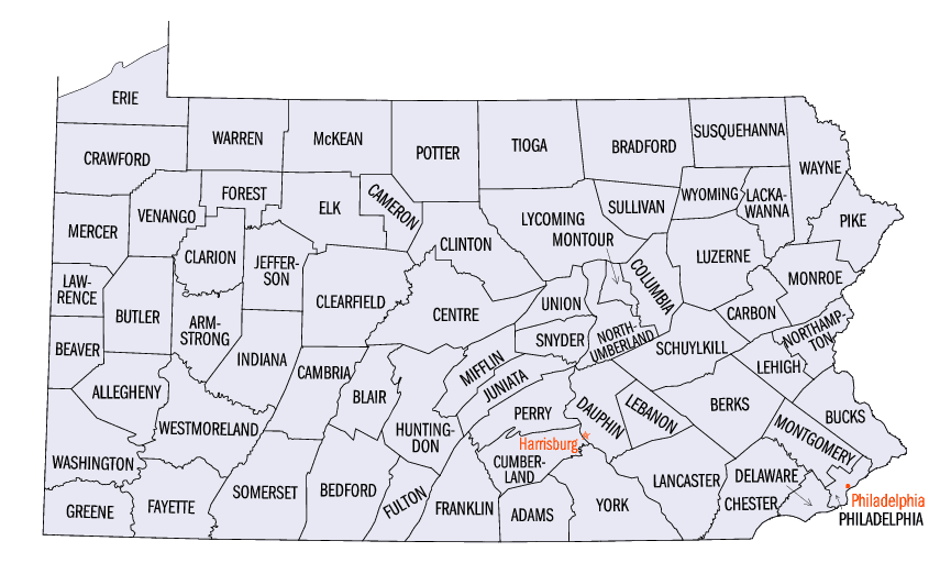
Pennsylvania Counties
There are sixty-seven counties of the Commonwealth of Pennsylvania in the United States of America. The city of Philadelphia is coterminous with Philadelphia County, and governmental functions have been consolidated since 1854.Forest County, Pennsylvania
Forest County Education, Geography, and History
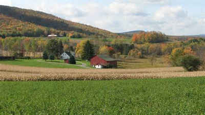
Forest County is a county located in Western Pennsylvania. Based on the 2010 census, the population was 7,716, making it the third-least populous county in Pennsylvania. Its county seat is Tionesta. The county was created in 1848 and later organized in 1857.
Etymology - Origin of Forest County Name
Named for its extensive forests.
Demographics:
County QuickFacts: CensusBureau Quick Facts
Forest County History
Created on April 1, 1848, from part
of Jefferson County. Part of Venango County was added on October 31, 1866. It
was named for its extensive forests. It was attached to Jefferson County until
1857 when Marienville became the county seat. Tionesta, the county seat after
1866, was incorporated as a borough on February 28, 1856, and was named for the
Tionesta Creek.
Tom Cook acquired the first timber lands near Cooksburg. Cyrus Blood founded
Marienville as a center for the lumber industry and succeeded in having the
county formed by the legislature. Leather tanning was an important enterprise.
Until about 1900 timber barons shaped events, but by then the original timber
was largely gone. The state purchased the Cook family lands and preserves them
for recreation. Today, the Allegheny National First covers over 40 percent of
the area, and additional lands are owned for commercial lumber production. There
was a brief oil boom, and glass was manufactured at Marienville from 1914 to
1982 relying on the abundance of natural gas, which produces intense heat
quickly. The population peak of 11,000 occurred in 1900. Farming has never been
very successful and is confined to only two percent of the countryside. The
construction of the Tionesta Creek Dam considerably altered the topography.
Forest County's border lines were not clearly defined until 1867.
Geography: Land and Water
As reported by the Census Bureau, the county has a total area of 431 square miles (1,117 km2), of which, 428
square miles (1,109 km2) of it is land and 3 square miles (8 km2) of it (0.76%) is water.
Neighboring Counties
Bordering counties are as follows:
- Warren County (north)
- McKean County (northeast)
- Elk County (east)
- Jefferson County (south)
- Clarion County (south)
- Venango County (west)
Education
The Forest Area School District serves the entire Forest County.


Click Image to Enlarge
