

Click Image to Enlarge
Pennsylvania Counties
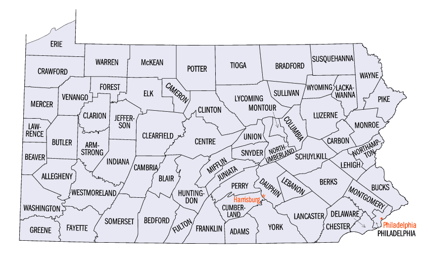
There are sixty-seven counties of the Commonwealth of Pennsylvania in the United States of America. The city of Philadelphia is coterminous with Philadelphia County, and governmental functions have been consolidated since 1854.Indiana County, Pennsylvania
Indiana County Education, Geography, and History
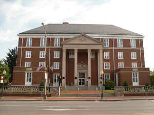
Indiana County is a county located in the state of Pennsylvania. Based on the 2010 census, the population was 88,880.Its county seat is
Indiana. The county was created on March 30, 1803, from parts of Westmoreland and Lycoming counties and later organized in 1806. It is
probably named for the Indiana Territory.
Indiana County comprises the Indiana, PA Micropolitan Statistical Area, which is also included in the Pittsburgh-New Castle-Weirton, PA-OH-WV
Combined Statistical Area. It is in the defined region of the Pittsburgh media market. Indiana County is served by three different area codes:
724, 814, and 582.
Etymology - Origin of Indiana County Name
Probably named for the Territory of Indiana.
Demographics:
County QuickFacts: CensusBureau Quick Facts
Indiana County History
Created on March 30, 1803 from parts
of Westmoreland and Lycoming Counties and probably named for the Territory of
Indiana. It was attached to Westmoreland County until 1806. Indiana, the county
seat, was laid out in 1805 and incorporated as a borough on March 11, 1816.
The southern region was acquired from Indians at the Treaty of Fort Stanwix in
1768 (the "New Purchase"), the northern region by the Treaty of Fort Stanwix of
1784 (the "Last Purchase"). First permanent settlement was about 1765.
Blairsville arose in 1818 and was a turnpike and canal center. The Pennsylvania
Railroad arrived in 1851. Salt production was the first industry. Iron furnaces
were unsuccessful. Timber cutting flourished from the 1840s to about 1890 when
the trees were depleted. A coal mining boom began in 1900 and dominated the
economy until 1924, boosting the population to nearly 80,000. Coal mining
revived in the 1970s; Indiana is the state's fifth highest bituminous producer,
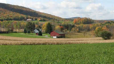
three-quarters of which is subsurface mined. Dairy farming and Christmas tree
sales buttress the economy today; 31 percent of the land is farmed. The
legendary Cherry Tree Joe McCreery and the actor Jimmy Stewart are cherished
local myths. Governor John S. Fisher, a Republican, was a county native.
Geography: Land and Water
As reported by the Census Bureau, the county has a total area of 834 square miles (2,161 km2), of which, 829
square miles (2,148 km2) of it is land and 5 square miles (13 km2) of it (0.60%) is water.
Neighboring Counties
Bordering counties are as follows:
- Jefferson County (north)
- Clearfield County (northeast)
- Cambria County (southeast)
- Westmoreland County (south)
- Armstrong County (west)
Education
Public school districts
Armstrong School District (part)
Apollo-Ridge School District (part)
Blairsville-Saltsburg School District (part)
Harmony Area School District (part)
Homer-Center School District
Indiana Area School District
Marion Center Area School District
Penns Manor Area School District
Punxsutawney Area School District (part)
Purchase Line School District (part)
United School District
Post-secondary education
Cambria-Rowe Business College – Indiana
Indiana University of Pennsylvania – Indiana
Westmoreland County Community College – Indiana
WyoTech – Blairsville


Click Image to Enlarge
