

Click Image to Enlarge
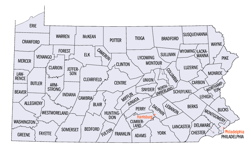
Pennsylvania Counties
There are sixty-seven counties of the Commonwealth of Pennsylvania in the United States of America. The city of Philadelphia is coterminous with Philadelphia County, and governmental functions have been consolidated since 1854.Lackawanna County, Pennsylvania
Lackawanna County Education, Geography, and History
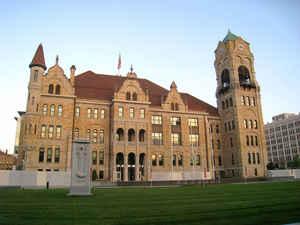
Lackawanna County is a county in the state of Pennsylvania. Based on the 2010 census, the population was 214,437. Its county seat and
largest city is Scranton. The county was created on August 13, 1878, from part of Luzerne County and is Pennsylvania's most recently
established county. It is named for the Lackawanna River.
Lackawanna County is included in the Scranton—Wilkes-Barre—Hazleton, PA Metropolitan Statistical Area ("Wyoming Valley").
Etymology - Origin of Lackawanna County Name
It was named for the Lackawanna River, a name meaning "stream that forks."
Demographics:
County QuickFacts: CensusBureau Quick Facts
Lackawanna County History
Created on August 13, 1878 from part
of Luzerne County, was the last county to be created. It was named for the
Lackawanna River, a name meaning "stream that forks." Scranton, the county seat,
was laid out in 1841, incorporated as a borough in 1856, and became a city on
April 23, 1866. It was named for the Scranton family, its founders. The county
adopted a home rule charter in April 1976.
The last county created, Lackawanna lies in the area bitterly disputed with
Connecticut settlers in the Yankee Pennamite Wars and with the Indians who
treasured the Wyoming Valley. Scranton, founded 1840 at Slocum Hollow, was
Wilkes Barre's rival and as the northern anthracite field expanded became
wealthier. The Scranton family has been leaders for more than a century. The
Scranton brothers developed anthracite iron smelting which led to the Lackawanna
Iron and Steel Company, a major economic factor until it was moved to New York
in 1902. The area was a center of labor unrest in 1877 and in all the major
anthracite mine strikes. The coal industry declined greatly in the late 1920s,
revived during World War II, and fell again in the 1960s. A small amount of coal
is still surface mined. Railroads once flourished, as the principal means of
exporting the coal. Textiles- silk, succeeded by rayon, followed by nylon- have
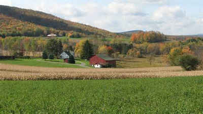
been important products. Lumber is still produced, but Lackawanna is not a
significant farming county; 14 percent of the land is farmland. Unemployment
became a problem for the region after World War II. William Warren Scranton,
banker and politician, was among the first to plan an economic recovery after
the coal industry collapsed in the 1960s, emphasizing a diversified business
environment.
Geography: Land and Water
As reported by the Census Bureau, the county has a total area of 465 square miles (1,203 km2), of which, 459
square miles (1,188 km2) of it is land and 6 square miles (15 km2) of it (1.27%) is water.
Neighboring Counties
Bordering counties are as follows:
- Susquehanna County (north)
- Wayne County (east)
- Monroe County (southeast)
- Luzerne County (southwest)
- Wyoming County (west)
Education
Colleges and universities
Baptist Bible College
Johnson College
Keystone College (also in Wyoming County)
Lackawanna College
Marywood University
Penn State Worthington Scranton
The Commonwealth Medical College
University of Scranton


Click Image to Enlarge
