

Click Image to Enlarge
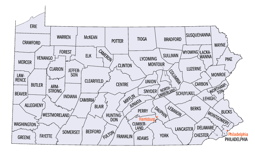
Pennsylvania Counties
There are sixty-seven counties of the Commonwealth of Pennsylvania in the United States of America. The city of Philadelphia is coterminous with Philadelphia County, and governmental functions have been consolidated since 1854.Lawrence County, Pennsylvania
Lawrence County Education, Geography, and History
Lawrence County is a county located in the state of Pennsylvania, United States. Based on the 2010 census, the population was 91,108. The
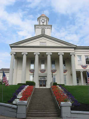
county seat is New Castle.
Lawrence County makes up the entire New Castle, PA Micropolitan Statistical Area, which is also included in the Pittsburgh-New Castle-Weirton,
PA-OH-WV Combined Statistical Area.
Etymology - Origin of Lawrence County Name
Named for Commodore Oliver Hazard Perry's first flagship, the US Brig Lawrence, which had been named for Captain James Lawrence, a naval hero.
Demographics:
County QuickFacts: CensusBureau Quick Facts
Lawrence County History
Created March 20, 1849, from parts of
Beaver and Mercer Counties and named for Commodore Oliver Hazard Perry's first
flagship, the US Brig Lawrence, which had been named for Captain James
Lawrence, a naval hero. New Castle, the county seat, was laid out in 1802,
incorporated as a borough on March 25, 1825, and chartered as a city on February
25, 1869. It is not certain whether it was named for Newcastle, England, or New
Castle, Delaware.
This area was formally acquired from Native Americans by the 1784 Treaty of Fort
Stanwix, the "Last Purchase," and migrants from Allegheny County began to settle
in 1793. Newcastle quickly grew to be an industrial center because the county
had limestone quarries, iron ore, and coal. Its stone blast furnaces for making
iron, started in 1838, were located in both Beaver and Mercer Counties, and the
county was created to eliminate that confusing situation. Canals arrived in the
1830s and the Pennsylvania Railroad in 1850. Connection with Youngstown, Ohio
was very important. The 1890s were the "Golden Age of Industry," as Lawrence
became the world's leader in tin plating. Lawrence also produced hardware,
paper, pottery, cement, and linseed oil. There was some oil production. The
industrial complex brought vast numbers of southern and eastern Europeans,
beginning in 1875. The population peaked at 113,000 in 1960, but
deindustrialization became pronounced in the 1970s.
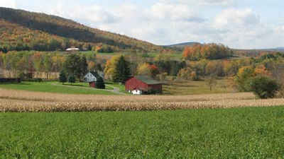
As in Berks County, there was always farming outside the factory areas. Today,
42 percent of the county is farmland. It ranks about midway in value of farm
products among the sixty-seven counties.
Geography: Land and Water
As reported by the Census Bureau, the county has a total area of 363 square miles (940 km2), of which, 360
square miles (934 km2) of it is land and 2 square miles (6 km2) of it (0.63%) is water.
Neighboring Counties
Bordering counties are as follows:
- Mercer County (north)
- Butler County (east)
- Beaver County (south)
- Columbiana County, Ohio (southwest)
- Mahoning County, Ohio (west)
Education
Colleges
Butler Community College Lawrence Crossing Campus
Erie Business College
Westminster College - New Wilmington
Public school districts
Blackhawk School District (part)
Ellwood City Area School District (part)
Laurel School District (Home of the Spartans)
Mohawk Area School District
Neshannock Township School District
New Castle Area School District
Shenango School District
Union Area School District
Wilmington Area School District (part)
Tech schools
Erie Business Center South - New Castle (Closed 2014)
Lawrence County Career Technology Center - New Castle
New Castle School of Trades - New Castle


Click Image to Enlarge
