

Click Image to Enlarge
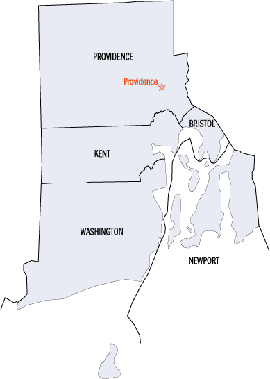
Rhode Island Counties
There are five counties in the state of Rhode Island. Rhode Island has the second lowest number of counties of any US state (only Delaware has fewer, with three counties). Although Rhode Island is divided into counties, it does not have any local government at the county level.Washington County, Rhode Island
Washington County Education, Geography, and History
Washington County, known locally as South County, is a county located in the state of Rhode Island. Based on the 2010 census, the
population was 126,979. Rhode Island counties, including Washington County, have no governmental functions other than as court administrative
and sheriff corrections boundaries, which are part of the state government.
Washington County is included in the Providence-Warwick, RI-MA Metropolitan Statistical Area, which is also included in the
Boston-Worcester-Providence, MA-RI-NH-CT Combined Statistical Area.
Etymology - Origin of Washington County Name
Renamed for first American President George Washington and was formerly named King's Province, after King Charles II of England. (It is usually called South County by Rhode Islanders.)
Demographics:
County QuickFacts: CensusBureau Quick Facts
Washington County History
Washington County Has No Form Of County Government.
Parent County: Newport
Washington County is a county located in the southwestern part of the US state of Rhode Island. Washington County
borders Kent County to the north, New London County in Connecticut to the west, Suffolk County in New York to the
southwest and Newport County, Rhode Island to the east.
Originally named King's County and changed to its present name in 1781, the county is usually known within the state as
South County.
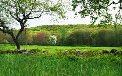
Geography: Land and Water
As reported by the Census Bureau, the county has a total area of 563 square miles (1,458 km2), of which, 333 square miles (862 km2) of it is land and 230 square miles (596 km2) of it (40.87%) is water.
The county's topography ranges from flat along the
shoreline to gently rolling hills further inland. The highest point is a large area approximately 560 feet (171 m)
in the Exeter neighborhood of Black Plain; the lowest point is sea level along the coast.
Neighboring Counties
Bordering counties are as follows:
- Kent County: north
- New London County in Connecticut: west
- Suffolk County in New York: southwest
- Newport County, Rhode Island: east
Education


Click Image to Enlarge
