


Click Image to Enlarge
South Carolina Counties
South Carolina is made up of fourty-six counties. They range in size from 392 square miles (1,016 square kilometers) in the case of Calhoun County to 1,358 square miles (3,517 square kilometers) in the case of Charleston County. The least populous county is McCormick County, with only 9,958 residents, while the most populous county is Greenville County, with a population of 395,357, despite the state's most populous city, Columbia, being located in Richland County.Anderson County, South Carolina
Anderson County Education, Geography, and History
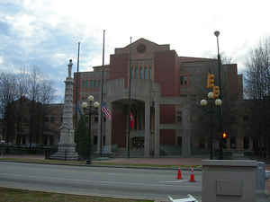
Anderson County is a county located in the state of South Carolina. Based on the 2010 census, its population was 187,126. Its county seat is
Anderson. Named for Revolutionary War leader Robert Anderson, the county is located in northwestern South Carolina, along the Georgia border.
Anderson County is included in the Greenville-Anderson-Mauldin, SC Metropolitan Statistical Area.
Etymology - Origin of Anderson County Name
Anderson County and its county seat, Anderson, were named for Revolutionary War general Robert Anderson (1741-1812).
Demographics:
County QuickFacts: CensusBureau Quick Facts
Anderson County History
Anderson County and its county seat, Anderson, were named for Revolutionary War general Robert Anderson (1741-1812). This region was occupied by the Cherokee Indians until 1777, when it was ceded by treaty to the state. Part of the "Indian Land" became Pendleton District (also called Washington District at one time.) The area was given its present name in 1826, when Pendleton District was split into Anderson and Pickens. Most of the early settlers of this area were Scotch-Irish farmers who moved south from Pennsylvania and Virginia in the eighteenth century. The oldest town in the county is Pendleton, which was founded around 1790; it became a popular summer resort for lowcountry planters in the nineteenth century. Some famous residents of Anderson County were United States senator and governor Olin D. Johnston (1896-1965), business leader Charles E. Daniel (1895-1964), and composer Lily Strickland (1884-1958).
Geography: Land and Water
As reported by the Census Bureau, the county has a total area of 757 square miles (1,962 km2), of which, 718 square miles (1,860 km2) of it is land and 39 square miles (102 km2) of it (5.21%) is water.
Anderson County contains 55,950-acre (226 km2) Lake Hartwell, a US Army Corps of Engineers lake with nearly 1,000 miles (2,000
km) of shoreline for residential and recreational use.
Neighboring Counties
Bordering counties are as follows:
- Pickens County, South Carolina - north
- Greenville County, South Carolina - northeast
- Laurens County, South Carolina - east
- Abbeville County, South Carolina - south
- Elbert County, Georgia - southwest
- Pickens County, South Carolina - west
- Hart County, Georgia - west
- Oconee County, South Carolina - northwest
Education
It is the home of Anderson University, a private, selective comprehensive university of approximately 3,000 undergraduate and graduate students.


Click Image to Enlarge
