


Click Image to Enlarge
South Carolina Counties
South Carolina is made up of fourty-six counties. They range in size from 392 square miles (1,016 square kilometers) in the case of Calhoun County to 1,358 square miles (3,517 square kilometers) in the case of Charleston County. The least populous county is McCormick County, with only 9,958 residents, while the most populous county is Greenville County, with a population of 395,357, despite the state's most populous city, Columbia, being located in Richland County.Barnwell County, South Carolina
Barnwell County Education, Geography, and History
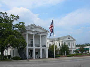
Barnwell County is a county located in the state of South Carolina. Based on the 2010 census, its population was 22,621. The Barnwell District was created in 1797 (effective in 1800) from the southwestern portion of the Orangeburg District, along the Savannah River. It was named after John Barnwell, a local figure in the Revolutionary War. Its county seat is Barnwell.
Etymology - Origin of Barnwell County Name
Barnwell County and its county seat of Barnwell were named for Revolutionary War leader John Barnwell (1748-1800).
Demographics:
County QuickFacts: CensusBureau Quick Facts
Barnwell County History
Barnwell County and its county seat of Barnwell were named for Revolutionary War leader John Barnwell (1748-1800). The county was originally part of Orangeburg District, and in 1785 it was named Winton County. It was given its current name in 1800. Barnwell County has decreased in size over the years as new counties were created within its boundaries (Aiken in 1871, Bamberg in 1897 and Allendale in 1919). The South Carolina Railroad, which connected Charleston to Hamburg on the Savannah River, was built through this area, creating the towns of Blackville and Williston in the mid-nineteenth century. In more recent years the county was the home of several powerful state politicians, known collectively as the "Barnwell Ring." Included were state Senator Edgar A. Brown (1888-1975), Speaker of the House Solomon Blatt (1895-1986), and Governor Joseph E. Harley (1880-1942).
Geography: Land and Water
As reported by the Census Bureau, the county has a total area of 557 square miles (1,443 km2), of which, 548 square miles (1,420 km2) of it is land and 9 square miles (23 km2) of it (1.59%) is water.
Neighboring Counties
Bordering counties are as follows:
- Aiken County, South Carolina - north
- Bamberg County, South Carolina - east
- Orangeburg County, South Carolina - east
- Allendale County, South Carolina - southeast
- Burke County, Georgia - southwest
Education


Click Image to Enlarge
