


Click Image to Enlarge
South Carolina Counties
South Carolina is made up of fourty-six counties. They range in size from 392 square miles (1,016 square kilometers) in the case of Calhoun County to 1,358 square miles (3,517 square kilometers) in the case of Charleston County. The least populous county is McCormick County, with only 9,958 residents, while the most populous county is Greenville County, with a population of 395,357, despite the state's most populous city, Columbia, being located in Richland County.Marlboro County, South Carolina
Marlboro County Education, Geography, and History
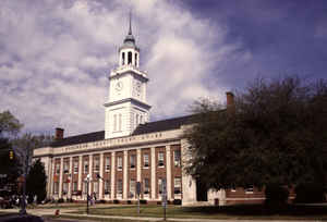
Marlboro County is a county located in the state of South Carolina. Based on the 2010 census, it population to be 28,933. Its
county seat is Bennettsville. The Great Pee Dee River runs through it.
Marlboro County comprises the Bennettsville, SC Micropolitan Statistical Area.
Etymology - Origin of Marlboro County Name
Marlboro is named after John Churchill, 1st Duke of Marlborough.
Demographics:
County QuickFacts: CensusBureau Quick Facts
Marlboro County History
Marlboro County was named for John Churchill, first Duke of Marlborough (1650-1722). The county name was originally spelled Marlborough, but it was later shortened. The county was created in 1785 as a part of Cheraws District. Welsh Baptists from Delaware settled in an area of the county known as Welsh Neck around 1737, and they were later joined by English and Scotch-Irish settlers. Cotton growing made this a wealthy part of the state prior to the Civil War. The town of Blenheim was also known for its mineral springs. General Sherman's troops passed through the county in 1865, briefly occupying the town of Bennettsville. Some famous Marlboro County natives are US Congressman and diplomat Robert Blair Campbell (1791-1862), US and Confederate Congressman John McQueen (1804-1867), and children's advocate Marian Wright Edelman.
Geography: Land and Water
As reported by the Census Bureau, the county has a total area of 485 square miles (1,257 km2), of which, 480
square miles (1,242 km2) of it is land and 6 square miles (14 km2) of it (1.15%) is water.
Neighboring Counties
Bordering counties are as follows:
- Richmond County, North Carolina - north
- Scotland County, North Carolina - northeast
- Robeson County, North Carolina - east
- Dillon County, South Carolina - east
- Florence County, South Carolina - south
- Darlington County, South Carolina - southwest
- Chesterfield County, South Carolina - west
- Anson County, North Carolina - northwest
Education


Click Image to Enlarge
