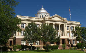
Texas Counties
Texas is divided into two hundred and fifty-four counties, more than any other state. Texas was originally divided into municipalities, a unit of local government under Spanish and Mexican rule. When the Republic of Texas gained its independence in 1836, there were 23 municipalities, which became the original Texas counties. Many of these would later be divided into new counties. The most recent county to be created was Kenedy County in 1921. The most recent county to be organized was Loving County in 1931Anderson County, Texas
Anderson County Education, Geography, and History

Anderson County is a county located in the state of Texas. Based on the 2010 census, the population was 58,458. Its county seat is
Palestine. Anderson county was organized in 1846 and is named in honor of Kenneth L. Anderson, who had been Vice President of the Republic
of Texas.
Anderson County comprises the Palestine, TX Micropolitan Statistical Area.
Etymology - Origin of Anderson County Name
Kenneth Lewis Anderson, the last vice president of the Republic of Texas
Demographics:
County QuickFacts: CensusBureau Quick Facts
Anderson County History
Indians friendly to the settlers resided in east Texas before the Kiowa, Kickapoo, Kichai, Apache and Comanche
intruded upon their territory. These tribes hunted, farmed the land, and were adept traders. By 1772 they had settled on the Brazos at
Waco and on the Trinity upstream from the site of present Palestine. The Tawakoni branch of Wichita Indians originated north of Texas, but
migrated south into east Texas. From 1843 onward, the Tawakoni were part of treaties made by both the Republic of Texas and the United
States.
On May 19, 1836 an alliance of Comanche, Kiowa, Caddo and Wichita attacked Fort Parker, killing or kidnapping all but about 18 settlers
who managed to escape to Fort Houston, which had been erected in Anderson County in 1835 as protection against Indians. Among the captured
was Cynthia Ann Parker, who later became mother of Comanche Chief Quanah Parker. Some residents of Anderson County are related to Cynthia
Ann Parker.
In October 1838, Gen. Thomas Jefferson Rusk conducted a raid against hostile Indians at Kickapoo, near Frankston, ending the engagements
with the Indians in eastern Texas for that year.
The First Legislature of the state of Texas formed Anderson County from Houston County on March 24, 1846. The county was named after Kenneth Lewis Anderson. Palestine was named county seat.
Handbook of Texas Online
After the removal of the Indians in the 1840s, settlement proceeded rapidly until the area had sufficient inhabitants
to form a new county. In response to a petition presented by settlers at and around Fort Houston, the First Legislature
of the state of Texas formed Anderson County from Houston County on March 24, 1846. A suggestion was made that the new
county be called Burnet in honor of David G. Burnet. The county was named Anderson, however, after Kenneth Lewis
Anderson, a prominent member of Congress and the last vice president of the Republic
of Texas. Fort Houston was two miles from the center of the county, so a committee,
composed of Dan Lumpkin, William Turner Sadler, and John Parker was appointed to lay
out the site for and name a new county seat. They chose a 100-acre tract in the center of the county. The Parkers had
come from Palestine, Crawford County, Illinois, and upon their suggestion, the new county seat was named Palestine. More at
Georgia Kemp
Caraway, "ANDERSON COUNTY," Handbook of Texas Online (http://www.tshaonline.org/handbook/online/articles/hca01),
accessed January 22, 2016. Uploaded on June 9, 2010. Modified on December 19, 2013. Published by the Texas State Historical Association.
Geography: Land and Water
As reported by the Census Bureau, the county has a total area of 1,078 square miles (2,792 km2), of which, 1,071 square miles (2,773 km2) of it is land and 7 square miles (19 km2) of it (0.66%) is water.
Neighboring Counties
Bordering counties are as follows:
- Henderson County (north)
- Cherokee County (east)
- Houston County (south)
- Leon County (southwest)
- Freestone County (west)
Education
The following school districts serve areas in Anderson County:
Athens Independent School District (partial)
Cayuga Independent School District
Elkhart Independent School District (partial)
Frankston Independent School District (partial)
La Poynor Independent School District (partial)
Neches Independent School District
Palestine Independent School District
Slocum Independent School District
Westwood Independent School District


