


Click Image to Enlarge
Texas Counties
Texas is divided into two hundred and fifty-four counties, more than any other state. Texas was originally divided into municipalities, a unit of local government under Spanish and Mexican rule. When the Republic of Texas gained its independence in 1836, there were 23 municipalities, which became the original Texas counties. Many of these would later be divided into new counties. The most recent county to be created was Kenedy County in 1921. The most recent county to be organized was Loving County in 1931Atascosa County, Texas
Atascosa County Education, Geography, and History
Atascosa County is a county located in the state of Texas. Based on the 2010 census, the population was 44,911. Its county seat is
Jourdanton. The county was formed in 1856 from Bexar County and is named for the Atascosa River.
Atascosa County is part of the San Antonio-New Braunfels, TX Metropolitan Statistical Area.
Etymology - Origin of Atascosa County Name
the Spanish word for boggy
Demographics:
County QuickFacts: CensusBureau Quick Facts
Atascosa County History
Atascosa County is a county located in the US state of Texas, and was formed in 1856 from Bexar County. Atascosa is named for the Atascosa River.
Handbook of Texas Online
The area was sparsely settled by the mid-1850s, and in 1856 the county was marked off from Bexar County. The
first county seat, Navatasco, was established in 1857 on land donated by Navarro. Among the county's early settlers
were Peter Tumlinson,qv who organized one of the first Ranger companies in the state in 1836, Indian fighter Thomas
Rodriguez, George F. Hindes, Marshall Burney, and Eli Johnson. In 1858 Pleasanton, a newly founded community, became
county seat, and a new courthouse was constructed. Settlers continued to trickle in, but the threat of Indian
attack, poor roads, and the area's general isolation kept the population low. More at
Linda Peterson, "ATASCOSA COUNTY," Handbook of Texas Online (http://www.tshaonline.org/handbook/online/articles/hca07),
accessed January 23, 2016. Uploaded on June 9, 2010. Modified on January 22, 2016. Published by the Texas State Historical Association.
Geography: Land and Water
As reported by the Census Bureau, the county has a total area of 1,236 square miles (3,200 km2), of which,
1,232 square miles (3,191 km2) of it is land and 3 square miles (9 km2) of it (0.28%) is water.
Neighboring Counties
Bordering counties are as follows:
- Bexar County (north)
- Wilson County (northeast)
- Karnes County (east)
- Live Oak County (southeast)
- McMullen County (south)
- La Salle County (southwest)
- Frio County (west)
- Medina County (northwest)
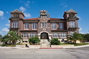
Education
The following school districts serve Atascosa County:
Charlotte Independent School District (partially)
Jourdanton Independent School District
Karnes City Independent School District (partially)
Lytle Independent School District (partially)
Pleasanton Independent School District
Poteet Independent School District
Somerset Independent School District (partially)


Click Image to Enlarge
