


Click Image to Enlarge
Texas Counties
Texas is divided into two hundred and fifty-four counties, more than any other state. Texas was originally divided into municipalities, a unit of local government under Spanish and Mexican rule. When the Republic of Texas gained its independence in 1836, there were 23 municipalities, which became the original Texas counties. Many of these would later be divided into new counties. The most recent county to be created was Kenedy County in 1921. The most recent county to be organized was Loving County in 1931Castro County, Texas
Castro County Education, Geography, and History
Castro County is a county located in the state of Texas. Based on the 2010 census, its population was 8,062. The county seat is Dimmitt. The county was named for Henri Castro, who was consul general to France for the Republic of Texas and the founder of a colony in Texas.
Etymology - Origin of Castro County Name
Henri Castro, a French consul general for the Republic of Texas and founder of a colony in Texas
Demographics:
County QuickFacts: CensusBureau Quick Facts
Castro County History
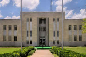
The county was originally created from Bexar County on August 21, 1876. It was organized in 1891, and a courthouse was built about the town square. Temporary county office space, meanwhile, was obtained from businessman J.N. Morrison. The ornate two-story courthouse was completed but was destroyed by lightning in 1906. It is named for Henri Castro, who was consul general to France for the Republic of Texas and founder of a colony in Texas. The seat of the county is Dimmitt.
Handbook of Texas Online
The area now known as Castro County was once occupied by Apaches, who were forced out of the region by Comanches
around 1720. The Comanches ruled the Panhandle-Plains area until they were defeated by the United States Army in the
Red River War of 1874. The Indians were confined to reservations in Indian
Territory during 1875 and 1876. Buffalo hunters arrived in the region in 1876 and by the early 1880s had eliminated
the last remnants of the formerly huge herds. The Texas legislature established Castro County in 1876. More at
Donald R. Abbe, "CASTRO COUNTY," Handbook of Texas Online (http://www.tshaonline.org/handbook/online/articles/hcc08),
accessed January 23, 2016. Uploaded on June 12, 2010. Published by the Texas State Historical Association.
Geography: Land and Water
As reported by the Census Bureau, the county has a total area of 899 square miles (2,329 km2), of which, 898
square miles (2,327 km2) of it is land and 1 square miles (2 km2) of it (0.11%) is water.
Neighboring Counties
Bordering counties are as follows:
- Deaf Smith County (north)
- Randall County (northeast)
- Swisher County (east)
- Hale County (southeast)
- Lamb County (south)
- Parmer County (west)
Education


Click Image to Enlarge
