


Click Image to Enlarge
Texas Counties
Texas is divided into two hundred and fifty-four counties, more than any other state. Texas was originally divided into municipalities, a unit of local government under Spanish and Mexican rule. When the Republic of Texas gained its independence in 1836, there were 23 municipalities, which became the original Texas counties. Many of these would later be divided into new counties. The most recent county to be created was Kenedy County in 1921. The most recent county to be organized was Loving County in 1931Coke County, Texas
Coke County Education, Geography, and History
Coke County is a county located on the Edwards Plateau in the state of Texas. Based on the 2010 census, its population was 3,320. Its county seat is Robert Lee. The county was founded in 1889 and is named for Richard Coke, the fifteenth governor of Texas.
Etymology - Origin of Coke County Name
Richard Coke, the fifteenth governor of Texas
Demographics:
County QuickFacts: CensusBureau Quick Facts
Coke County History
From about 1700 to the 1870s, Comanche, Tonkawa, Lipan Apache, Kickapoo and Kiowa roamed the county. These tribes
settled in rock-shelters in the river and creek valleys, leaving behind artifacts and caches of seeds, implements, burial sites, and
petroglyphs, river shells, turkey and deer bones, flint knives, scrapers, and points.
In 1851 United States Army post Fort Chadbourne was established to protect the frontier, and the fort was manned until the Civil War. The
Butterfield Overland Mail ran through the area from 1858 to 1861.
Between 1860 and the early 1880s, the only settlers in what became Coke County were ranchers attracted to open grazing land. J. J. Austin
established his ranch headquarters near Sanco in 1875. Pate Francher settled in the area in 1877.
In 1882, the Texas and Pacific Railway began providing service to San Angelo, and settlers started coming into the region in somewhat larger
numbers.
Severe drought in the 1880s led to fence cutting and its attendant issues. State authorities eventually settled the disputes.
A few years later, the county was named after a confederate soldier, a Texas leader, a governor, and a U.S senator named Richard Coke.
The Texas legislature established Coke County in 1889, out of Tom Green County. The county was organized that same year, with Hayrick as
county seat.
In 1891, after an election, the new town of Robert Lee became the county seat. Robert E. Lee had once served at Fort Chadbourne.
Handbook of Texas Online
The Texas legislature established Coke County in 1889, carving it out of territory previously assigned to Tom
Green County; the county was organized that same year, with Hayrick as county seat. In 1889 the county's first
newspaper, the Hayrick Democrat, began publication; shortly thereafter it was renamed the Rustler. By
1890 there were 163 farms and ranches in the county, and 2,059 people lived there. Only about 4,000 acres of the
county was classified by the census as "improved" at this time. Ranching
dominated the local economy, and 13,806 cattle were counted in Coke County that year. More at
William R. Hunt and John Leffler, "COKE COUNTY," Handbook of Texas Online (http://www.tshaonline.org/handbook/online/articles/hcc14),
accessed January 23, 2016. Uploaded on June 12, 2010. Published by the Texas State Historical Association.
Geography: Land and Water
As reported by the Census Bureau, the county has a total area of 928 square miles (2,403 km2), of which, 899
square miles (2,328 km2) of it is land and 29 square miles (76 km2) of it (3.14%) is water.
Neighboring Counties
Bordering counties are as follows:
- Nolan County (north)
- Runnels County (east)
- Tom Green County (south)
- Sterling County (west)
- Mitchell County (northwest)
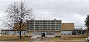
Education


Click Image to Enlarge
