


Click Image to Enlarge
Texas Counties
Texas is divided into two hundred and fifty-four counties, more than any other state. Texas was originally divided into municipalities, a unit of local government under Spanish and Mexican rule. When the Republic of Texas gained its independence in 1836, there were 23 municipalities, which became the original Texas counties. Many of these would later be divided into new counties. The most recent county to be created was Kenedy County in 1921. The most recent county to be organized was Loving County in 1931Collin County, Texas
Collin County Education, Geography, and History
Collin County is a county located in the state of Texas. Based on the 2010 census, the county's population was 782,341, making
it the seventh-most populous county in Texas and the 63rd largest county by population in the United States. Its county seat is McKinney.
Collin County is part of the Dallas-Fort Worth-Arlington, TX Metropolitan Statistical Area. A small portion of the city of Dallas is located
in the county.
Etymology - Origin of Collin County Name
Collin McKinney, an author of the Texas Declaration of Independence and its oldest signer (age 70 when he signed it), and early settler in the county
Demographics:
County QuickFacts: CensusBureau Quick Facts
Collin County History
Collin County, Texas, was was created 3 April 1846 from Fannin County when Texas became a state. Its seat is McKinney. The county and its seat are both named in honor of Collin McKinney, one of the five men who drafted the Texas Declaration of Independence and the oldest of the 59 men who signed it.
Handbook of Texas Online
Branches of the Caddo Indians inhabited the area before the arrival of the first white settlers. Occasional
outbreaks of violence occurred between the two groups, but there was no extended period of conflict since the Caddos
withdrew from the county by the mid-1850s. The absence of organized Indian resistance, combined with the county's
fertile soil and an offer of land grants by the Peters colony attracted settlers
to the area in the early 1840s. Even with the offer of free land, the estimated population of the county was only
150 when it was demarked from Fannin County on April 3, 1846, and named for Collin McKinney,
one of the first settlers of the county and a signer of the Texas Declaration of Independence.
The original county seat was Buckner. Because this town Buckner was not within three miles of the center of the
county, however, McKinney became the county seat in 1848. Like the county, McKinney was named for Collin McKinney. More at
David Minor, "COLLIN COUNTY," Handbook of Texas Online (http://www.tshaonline.org/handbook/online/articles/hcc16),
accessed January 23, 2016. Uploaded on June 12, 2010. Published by the Texas State Historical Association.
Geography: Land and Water
As reported by the Census Bureau, the county has a total area of 886 square miles (2,294 km2), of which, 848 square miles (2,195 km2) of it is land and 38 square miles (99 km2) of it (4.32%) is water.
Neighboring Counties
Bordering counties are as follows:
- Grayson County (north)
- Fannin County (northeast)
- Hunt County (east)
- Rockwall County (southeast)
- Dallas County (south)
- Denton County (west)
Education
Colleges and universities
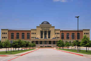
Collin College opened its first campus on Highway 380 in McKinney in 1985. The college has grown to seven campuses/locations—two in McKinney and two in Plano and as well as Frisco, Allen and Rockwall. Dallas Baptist University also has an extension site in Frisco, DBU Frisco. The majority of the University of Texas at Dallas campus in Richardson, Texas lies within Collin County.


Click Image to Enlarge
