


Click Image to Enlarge
Texas Counties
Texas is divided into two hundred and fifty-four counties, more than any other state. Texas was originally divided into municipalities, a unit of local government under Spanish and Mexican rule. When the Republic of Texas gained its independence in 1836, there were 23 municipalities, which became the original Texas counties. Many of these would later be divided into new counties. The most recent county to be created was Kenedy County in 1921. The most recent county to be organized was Loving County in 1931Colorado County, Texas
Colorado County Education, Geography, and History
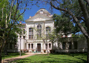
Colorado County is a county located in the state of Texas. Based on the 2010 census, its population was 20,874. Its county seat is Columbus. It is named for the Colorado River of Texas. The county was founded in 1836 and organized the next year.
Etymology - Origin of Colorado County Name
the Colorado River. The Colorado River, which means "colored red", was frequently confused by Spanish explorers with the Brazos River to the north. It is this confusion as well as an alleged mapping error that is believed to have led to its misnaming.
Demographics:
County QuickFacts: CensusBureau Quick Facts
Colorado County History
Colorado County, one of the original counties of the Republic of Texas, was formed in 1836 and organized in 1837, the first district court being held by Robert M. Williamson in April 1837 at Columbus, the county seat. Colorado is named for the Colorado River of Texas.
Handbook of Texas Online
Colorado County, one of the original counties of the Republic of Texas, was
formed in 1836 and organized in 1837, the first district court being held by Robert M. Williamson
in April 1837 at Columbus, the county seat. By 1840 there were 249 heads of families and 319 slaves in the county. A
German settlement grew up around the community of Frelsburg around 1839, and the first German university in the
state, Hermann University, was chartered there in 1844. Men from Colorado County made up most of Company E, First
Texas Mounted Riflemen, during the Mexican War. Cotton and corn were the main
crops grown in the 1840s. Among the more notable plantations in the county was that of Robert Robson, who arrived
from Dumfries, Scotland, about 1839 and built a concrete castle of homemade lime and gravel on his estate on the
south bank of the Colorado River. The castle, surrounded by a moat crossed by a drawbridge, was probably the first
building in Texas to have running water, and was a center of social life for the local planters. A steamboat, the
Flying Jenny, ran from the castle up the Colorado to Austin. The county was heavily dependent on the river for
transporting its crops in the 1840s and 1850s. Keelboats and flatboats operated in the early years of the county,
and by the 1840s the Moccasin Belle and other steamboats carried cotton from the county to Matagorda. Water
traffic was heavy until the Colorado became too blocked by a raft of floating and sunken timber. Railroads
displaced river navigation after the Civil War. More at
Mark Odintz, "COLORADO COUNTY," Handbook of Texas Online (http://www.tshaonline.org/handbook/online/articles/hcc18),
accessed January 23, 2016. Uploaded on June 12, 2010. Published by the Texas State Historical Association.
Geography: Land and Water
As reported by the Census Bureau, the county has a total area of 974 square miles (2,522 km2), of which, 963
square miles (2,494 km2) of it is land and 11 square miles (28 km2) of it (1.09%) is water.
Neighboring Counties
Bordering counties are as follows:
- Austin County (northeast)
- Wharton County (southeast)
- Jackson County (south)
- Lavaca County (southwest)
- Fayette County (northwest)
Education


Click Image to Enlarge
