


Click Image to Enlarge
Texas Counties
Texas is divided into two hundred and fifty-four counties, more than any other state. Texas was originally divided into municipalities, a unit of local government under Spanish and Mexican rule. When the Republic of Texas gained its independence in 1836, there were 23 municipalities, which became the original Texas counties. Many of these would later be divided into new counties. The most recent county to be created was Kenedy County in 1921. The most recent county to be organized was Loving County in 1931Crosby County, Texas
Crosby County Education, Geography, and History
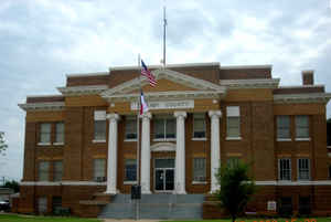
Crosby County is a county located in the state of Texas. Based on the 2010 census, its population was 6,059. The county seat is Crosbyton.
The county was founded in 1876 and later organized in 1886. Both the county and its seat are named for Stephen Crosby, a land commissioner in
Texas.
Crosby County, along with Lubbock County, and Lynn County, is part of the Lubbock Metropolitan Statistical Area (MSA). The Lubbock MSA and
Levelland Micropolitan Statistical Area , encompassing only Hockley County, form the larger Lubbock-Levelland Combined Statistical Area
(CSA).
Etymology - Origin of Crosby County Name
Stephen Crosby, a land commissioner
Demographics:
County QuickFacts: CensusBureau Quick Facts
Crosby County History
Crosby County is a county located in the US state of Texas. The seat of the county is Crosbyton. The county and its seat are both named for Stephen Crosby, a land commissioner in Texas.
Handbook of Texas Online
The Quaker colony flourished for a while as a cultural and economic center and attracted merchants and settlers;
in 1882 the colony established one of the first schools on the high plains. Crosby County was formally organized
after elections held in 1886, with Estacado (the new name of the town formerly called Marietta) designated as the
county seat. Open-range grazing continued until the mid-1880s, when barbed wire
was introduced and small ranchers and farmers began competing for the land. By 1890 the population of the county was
345. As more settlers moved in to establish farms and ranches, the influence of the Quakers declined and the
religious orientation of the community was lost. In 1891 Emma became the seat of government. Until the early
twentieth century, the county remained dominated by such large ranches as the St. Louis Cattle Company, the
Two-Buckle Ranch, the C. B. Livestock Company (founded in 1901) and smaller
spreads. Thanks to plentiful grass and sufficient water holes, and despite the lack of rail transportation in early
days, the beef-cattle industry thrived. In 1900, 30,618 cattle were counted in Crosby County, and in 1910 holdings
were about the same. More at
John Leffler, "CROSBY COUNTY," Handbook of Texas Online (http://www.tshaonline.org/handbook/online/articles/hcc27),
accessed January 23, 2016. Uploaded on June 12, 2010. Published by the Texas State Historical Association.
Geography: Land and Water
As reported by the Census Bureau, the county has a total area of 902 square miles (2,335 km2), of which, 900
square miles (2,330 km2) of it is land and 2 square miles (5 km2) of it (0.24%) is water.
Neighboring Counties
Bordering counties are as follows:
- Floyd County (north)
- Dickens County (east)
- Garza County (south)
- Lubbock County (west)
Education


Click Image to Enlarge
