


Click Image to Enlarge
Texas Counties
Texas is divided into two hundred and fifty-four counties, more than any other state. Texas was originally divided into municipalities, a unit of local government under Spanish and Mexican rule. When the Republic of Texas gained its independence in 1836, there were 23 municipalities, which became the original Texas counties. Many of these would later be divided into new counties. The most recent county to be created was Kenedy County in 1921. The most recent county to be organized was Loving County in 1931Dallas County, Texas
Dallas County Education, Geography, and History
Dallas County is a county located in the state of Texas. Based on the 2010 census, the population was 2,368,139. It is the second-most
populous county in Texas and the ninth-most populous in the United States. Its county seat is Dallas, which is also the third-largest city in
Texas and the ninth-largest city in the United States. The county was founded in 1846 and was possibly named for George Mifflin Dallas, the
11th Vice President of the United States under US President James K. Polk.
Dallas County is included in the Dallas-Fort Worth-Arlington, TX Metropolitan Statistical Area (colloquially referred to as the Dallas/Fort
Worth Metroplex).
Etymology - Origin of Dallas County Name
George Mifflin Dallas, the eleventh vice president of the United States
Demographics:
County QuickFacts: CensusBureau Quick Facts
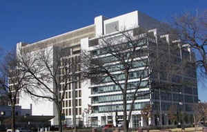
Dallas County History
Its county seat is Dallas, which is also the largest city in the county, the third-largest city in Texas, and the ninth-largest city in the United States. Dallas County is the most populous county within the metropolitan area and contains the largest of its principal cities. The county was named in honor of George Mifflin Dallas, the eleventh vice president of the United States.
Handbook of Texas Online
In 1845 voters in the future Dallas County approved the annexation of Texas to
the United States by a vote of 29 to 3. On March 30, 1846, Dallas County was officially formed by order of the state
legislature from portions of Nacogdoches and Robertson counties, and named probably for George Mifflin Dallas, vice
president of the United States under James K. Polk (see DALLAS, TEXAS). At Dallas, the temporary county seat,
a log cabin was built to serve as a courthouse. In 1850 an election was held to find a permanent county seat. A
runoff election was held after the first vote yielded 191 votes for Dallas, 178 for Hord's Ridge, and 101 for Cedar
Springs. Dallas beat Hord's Ridge 244 to 216 in the runoff. By 1850 Dallas County had a population of 2,743, and by
1860 the number of residents had almost tripled to 8,665. Though the slave population rose faster than the white
population, Dallas County had fewer slaves than some other Texas counties. In 1850 the 207 slaves were 8 percent of
the population, but by 1860 slaves constituted 12 percent of the population. These 1,074 slaves were owned by 228
slaveholders. In 1850 the county had two churches and ten one-teacher public schools with a total of 170 pupils. The
population resided on 278 farms with a value of $175,502. The largest crop was corn, with 94,870 bushels, and cotton
was a minor crop with only 44 bales. Cotton was originally grown primarily for home use, but by 1849 Farmers Branch
had the first cotton gin in the county. By 1860 wheat was a major Dallas County crop, and many gristmills had been
constructed to grind the grain. In 1850 stockmen raised more hogs (6,089) than cattle, but by 1860 cattle numbered
35,431 and sheep 20,974, while hogs numbered only 16,113. More at
Lisa C. Maxwell, "DALLAS COUNTY," Handbook of Texas Online (http://www.tshaonline.org/handbook/online/articles/hcd02),
accessed January 23, 2016. Uploaded on June 12, 2010. Published by the Texas State Historical Association.
Geography: Land and Water
As reported by the Census Bureau, the county has a total area of 908 square miles (2,352 km2), of which, 880
square miles (2,279 km2) of it is land and 29 square miles (75 km2) of it (3.19%) is water.
Neighboring Counties
Bordering counties are as follows:
- Collin County (north)
- Rockwall County (northeast)
- Kaufman County (east)
- Ellis County (south)
- Tarrant County (west)
- Denton County (northwest)
- Johnson County (southwest)
Education
The following school districts serve Dallas County:
Carrollton-Farmers Branch ISD (partly in Denton County)
Cedar Hill ISD
Coppell ISD
Dallas ISD
DeSoto ISD
Duncanville ISD
Ferris ISD (mostly in Ellis County)
Garland ISD
Grand Prairie ISD
Grapevine-Colleyville ISD (mostly in Tarrant County)
Highland Park ISD
Irving ISD
Lancaster ISD
Mesquite ISD
Richardson ISD
Sunnyvale ISD


Click Image to Enlarge
