


Click Image to Enlarge
Texas Counties
Texas is divided into two hundred and fifty-four counties, more than any other state. Texas was originally divided into municipalities, a unit of local government under Spanish and Mexican rule. When the Republic of Texas gained its independence in 1836, there were 23 municipalities, which became the original Texas counties. Many of these would later be divided into new counties. The most recent county to be created was Kenedy County in 1921. The most recent county to be organized was Loving County in 1931Edwards County, Texas
Edwards County Education, Geography, and History
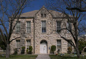
Edwards County is a county located on the Edwards Plateau in the state of Texas. Based on the 2010 census, its population was 2,002. The county seat is Rocksprings. The county was created in 1858 and later organized in 1883. It is named for Haden Edwards, an early settler of Nacogdoches, Texas. The Edwards Aquifer and Edwards Plateau are named after the county by reason of their locations
Etymology - Origin of Edwards County Name
Haden Edwards, an early settler of Nacogdoches, Texas
Demographics:
County QuickFacts: CensusBureau Quick Facts
Edwards County History
Edwards County is a county located in the US state of Texas. Edwards is named for Haden Edwards, an early settler of Nacogdoches, Texas. The seat of the county is Rocksprings
Handbook of Texas Online
The region that became Edwards County was home to Lipan Apache Indians. Spain established the mission of San
Lorenzo de la Santa Cruz in 1762 to help Christianize the Indians, but was otherwise unable to settle the area.
White settlement in the region did not begin until the mid-1800s. In 1858 the county was formed from Bexar County;
the first land was sold in 1876. Edwards County was not officially organized until 1883. It was named for Hayden
Edwards, one of the first American settlers of Nacogdoches. The county seat was
originally Bullhead, which subsequently changed its name to Vance. Rock Springs (now Rocksprings) became county seat
in 1891. In 1913, Real County was taken from the eastern section of Edwards County, thus decreasing Edwards County
to its present size. More at
James B. McCrain, "EDWARDS COUNTY," Handbook of Texas Online (http://www.tshaonline.org/handbook/online/articles/hce03),
accessed January 23, 2016. Uploaded on June 12, 2010. Published by the Texas State Historical Association.
Geography: Land and Water
As reported by the Census Bureau, the county has a total area of 2,120 square miles (5,491 km2), virtually all
of which is land.
Neighboring Counties
Bordering counties are as follows:
- Sutton County (north)
- Kimble County (northeast)
- Kerr County (east)
- Real County (southeast)
- Uvalde County (southeast)
- Kinney County (south)
- Val Verde County (west)
Education


Click Image to Enlarge
