


Click Image to Enlarge
Texas Counties
Texas is divided into two hundred and fifty-four counties, more than any other state. Texas was originally divided into municipalities, a unit of local government under Spanish and Mexican rule. When the Republic of Texas gained its independence in 1836, there were 23 municipalities, which became the original Texas counties. Many of these would later be divided into new counties. The most recent county to be created was Kenedy County in 1921. The most recent county to be organized was Loving County in 1931Gonzales County, Texas
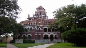
Gonzales County Education, Geography, and History
Gonzales County is a county located in the state of Texas. Based on the 2010 census, its population was 19,807. The county is named for its county seat, the city of Gonzales. The county was created in 1836 and organized the following year.
Etymology - Origin of Gonzales County Name
its county seat, which in turn was named for Rafael Gonzales, governor of Coahuila y Tejas.
Demographics:
County QuickFacts: CensusBureau Quick Facts
Gonzales County History
Gonzales County is a county located in the US state of Texas. It is named for its seat, the city of Gonzales
Handbook of Texas Online
Gonzales County, named for the capital of Green DeWitt's colony, was established in 1836 and organized in 1837 as
one of the original counties in the Republic of Texas. It occupied the same area
as DeWitt's colony-a territory some sixty miles long and twenty-five miles wide, with an area of 1,100 square miles.
After the annexation of Texas to the United States in 1845, portions of Gonzales
County were detached to form what are now the counties of Caldwell, Comal, DeWitt, Fayette, Guadalupe, Jackson,
Lavaca, and Victoria. James W. Robinson, the first official of Gonzales County,
was appointed district judge by the Congress of the Republic of Texas in 1836.
In 1837 an election was held for the "depopulated counties"; those settlers who had participated in the Runaway
Scrape or were temporarily living in other locations voted in this election. On December 14, 1837, the first
Gonzales county court was organized, with B. D. McClure as chief justice. The settlers of DeWitt's colony obtained
land grants and patents in the fertile blackland valleys of the Guadalupe and San Marcos rivers and along the major
creeks, including Plum Creek (now in Caldwell County), Rocky Creek (now in Lavaca County), Peach Creek (named Arroyo
de los Theodolites before Anglo settlement), Sandy Fork, and Sandies and Salt creeks. Early Gonzales County settlers
had established farms and ranches first in the river valleys, then in the sandy lands, and finally on the black
mesquite uplands. Settlers from soil-exhausted southern states quickly converted the rich alluvial soil into
productive acreage, finding it possible to grow peaches, grapes, plums, pears, figs, apples, and apricots. Timber
was harvested early in the county's history, and walnut was used by skilled local cabinetmakers. Some wheat was
raised in the early years, and all kinds of vegetables and some fruits have been raised throughout Gonzales County
history, but cotton and corn became the chief crops in the county. Salt was pressed by the pioneers on the salt
flats near Pilgrim but was never produced in commercial quantities. By 1840, cotton, corn, potatoes, sugarcane, rye,
oats, and barley were produced in abundance, along with significant numbers of hogs and sheep. Early trade passed
through Indianola, roughly 100 miles away. More at
Dorcas Huff Baumgartner and Genevieve B. Vollentine, "GONZALES COUNTY," Handbook of Texas Online(http://www.tshaonline.org/handbook/online/articles/hcg07),
accessed January 23, 2016. Uploaded on June 15, 2010. Modified on February 27, 2014. Published by the Texas State Historical Association.
Geography: Land and Water
As reported by the Census Bureau, the county has a total area of 1,070 square miles (2,771 km2), of which,
1,068 square miles (2,765 km2) of it is land and 2 square miles (6 km2) of it (0.19%) is water.
Neighboring Counties
Bordering counties are as follows:
- Fayette County (northeast)
- Lavaca County (east)
- Dewitt County (southeast)
- Karnes County (southwest)
- Wilson County (southwest)
- Guadalupe County (west)
- Caldwell County (northwest)
Education


Click Image to Enlarge
