


Click Image to Enlarge
Texas Counties
Texas is divided into two hundred and fifty-four counties, more than any other state. Texas was originally divided into municipalities, a unit of local government under Spanish and Mexican rule. When the Republic of Texas gained its independence in 1836, there were 23 municipalities, which became the original Texas counties. Many of these would later be divided into new counties. The most recent county to be created was Kenedy County in 1921. The most recent county to be organized was Loving County in 1931Haskell County, Texas
Haskell County Education, Geography, and History
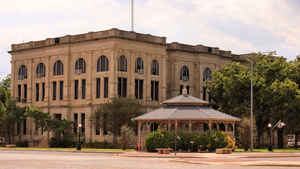
Haskell County is a county located in the state of Texas. Based on the 2010 census, its population was 5,899. The county seat is Haskell. The county was created in 1858 and later organized in 1885. It is named for Charles Ready Haskell, who was killed in the Goliad massacre.
Etymology - Origin of Haskell County Name
Charles Ready Haskell, killed in the Goliad Massacre
Demographics:
County QuickFacts: CensusBureau Quick Facts
Haskell County History
Haskell County is a county located in the US state of Texas. IIt is named for Charles Ready Haskell, who was killed in the Goliad massacre. The seat of the county is Haskell
Handbook of Texas Online
In 1858 the Texas legislature formed Haskell County from lands formerly assigned to Milam and Fannin counties.
Because of Indian hostility in the area, however, the county remained unsettled for nearly two decades. During this
period several Indian fights took place in the county, including an engagement at Double Mountain on April 3, 1867 (see
REYNOLDS, GEORGE THOMAS), and Capt. Adna R. Chaffee's fight on South Point
(California) Creek near the Jones county line in March 1868. By 1876 the Indian menace had subsided, and the county
was reestablished. J. Wright Mooar and other hunters operating out of Fort
Griffin slaughtered the buffalo herds that roamed through the area; mustangs
that frequented the springs in the county were rounded up in annual drives. Ranchers began moving into the area in
1877, when George T. Reynolds and John A. Matthews established their ranch
headquarters on California Creek. In 1879 Thomas F. Tucker, remembering the description of the area written by his
brother Dick, settled near the Matthews ranchhouse and began his own cattle operation. Sometime later W. R.
Standifer, a former buffalo hunter, brought a flock of sheep to Willow Pond, or Rice Springs, near the center of the
county. The 1880 census found forty-eight people living in the county; the agricultural census reported two ranches
in the county that year More at
John Leffler, "HASKELL COUNTY," Handbook of Texas Online (http://www.tshaonline.org/handbook/online/articles/hch10),
accessed January 24, 2016. Uploaded on June 15, 2010. Published by the Texas State Historical Association.
Geography: Land and Water
As reported by the Census Bureau, the county has a total area of 910 square miles (2,358 km2), of which, 903
square miles (2,339 km2) of it is land and 7 square miles (19 km2) of it (0.80%) is water.
Neighboring Counties
Bordering counties are as follows:
- Knox County (north)
- Throckmorton County (east)
- Shackelford County (southeast)
- Jones County (south)
- Stonewall County (west)
Education


Click Image to Enlarge
