


Click Image to Enlarge
Texas Counties
Texas is divided into two hundred and fifty-four counties, more than any other state. Texas was originally divided into municipalities, a unit of local government under Spanish and Mexican rule. When the Republic of Texas gained its independence in 1836, there were 23 municipalities, which became the original Texas counties. Many of these would later be divided into new counties. The most recent county to be created was Kenedy County in 1921. The most recent county to be organized was Loving County in 1931Kendall County, Texas
Kendall County Education, Geography, and History
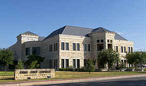
Kendall County is a county located on the Edwards Plateau in the state of Texas. In 2010 census, its population was 33,410. Its county
seat is Boerne. The county is named for George Wilkins Kendall, a journalist and Mexican-American War correspondent.
Kendall County is part of the San Antonio-New Braunfels, TX Metropolitan Statistical Area.
Etymology - Origin of Kendall County Name
George Wilkins Kendall, an early journalist and sheep rancher
Demographics:
County QuickFacts: CensusBureau Quick Facts
Kendall County History
Kendall County is a county located in the US state of Texas. Its seat is Boerne. The county is named for George Wilkins Kendall, a journalist and Mexican-American War correspondent.
Handbook of Texas Online
Most of the Kendall County area was part of the Bexar County established by the Republic of Texas
in 1836; it later became part of Kerr County, which was separated from Bexar in 1856. Comfort served as county seat
of Kerr County for two years before Kendall County was formed. In 1859 residents of Boerne and Sisterdale petitioned
the legislature for a new county; the legislature granted the petition in 1862, and the new county, carved from Kerr
and Blanco counties, was named in honor of George Wilkins Kendall. The first
Kendall County officials were elected later that year, and Boerne was chosen as the county seat. The earliest
schools in the area were private institutions that met in someone's home or in donated space. The first public
schools were organized at Comfort in 1856 and at Boerne in 1857. Although the legislature had authorized a district
system in 1854, the system was not put into effect before the 1870s or 1880s. Shortly after 1900 Kendall County had
twenty-two common school districts. It was not until the 1930s and 1940s that improved transportation made
large-scale consolidation of schools into independent school districts possible. Until the mid-twentieth century
extensive schooling was for many children a luxury that took second place to their duties on the family farm, and
drop-out rates were high. As late as 1940 less than 9 percent of the population over the age of twenty-five had
completed high school. The percentage of residents who finished school began to rise as the job market in nearby San
Antonio expanded. By 1960, 20 percent were high school graduates, and by 1980 the number represented nearly 65
percent of the population over twenty-five. Religious development in the county was fairly slow. Many of the early
German immigrants were "freethinkers" and were not particularly receptive to
organized religion. In the 1840s and 1850s a priest from the cathedral in San Antonio traveled to the area
occasionally to provide services to those people who wanted them. A priest was assigned to Boerne in 1860, but
because of local sentiment, built his church on a hill outside the town. As more people moved into the area,
however, more churches were established. A Methodist congregation was organized in the mid-1870s, an Episcopal
church in 1881, and a Lutheran church in 1891. In the early 1980s the county's fifteen churches had an estimated
combined membership of 5,514; Catholic, Southern Baptist, and American Lutheran were the largest denominations More at
Vivian Elizabeth Smyrl, "KENDALL COUNTY," Handbook of Texas Online (http://www.tshaonline.org/handbook/online/articles/hck03),
accessed January 24, 2016. Uploaded on June 30, 2010. Published by the Texas State Historical Association.
Geography: Land and Water
As reported by the Census Bureau, the county has a total area of 663 square miles (1,717 km2), of which, 662
square miles (1,716 km2) of it is land and 1 square miles (2 km2) of it (0.09%) is water.
Neighboring Counties
Bordering counties are as follows:
- Gillespie County (north)
- Blanco County (northeast)
- Comal County (southeast)
- Bexar County (south)
- Bandera County (southwest)
- Kerr County (west)
Education


Click Image to Enlarge
