


Click Image to Enlarge
Texas Counties
Texas is divided into two hundred and fifty-four counties, more than any other state. Texas was originally divided into municipalities, a unit of local government under Spanish and Mexican rule. When the Republic of Texas gained its independence in 1836, there were 23 municipalities, which became the original Texas counties. Many of these would later be divided into new counties. The most recent county to be created was Kenedy County in 1921. The most recent county to be organized was Loving County in 1931La Salle County, Texas
La Salle County Education, Geography, and History
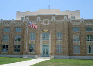
La Salle County is a county located in the state of Texas. Based on the 2010 census, its population was 6,886. Its county seat is Cotulla. The county was created in 1858 and later organized in 1880. It is named for Rene-Robert Cavelier, Sieur de La Salle, a 17th-century French explorer.
Etymology - Origin of La Salle County Name
Rene-Robert Cavelier, Sieur de La Salle, the French explorer who traveled through the Texas coast near the future county
Demographics:
County QuickFacts: CensusBureau Quick Facts
La Salle County History
The area of present-day La Salle County was occupied by the Coahuiltecan Indians until the 18th century, when they
were squeezed out by the Spanish from the south and the Apache from the north. After the Mexican War of Independence, the Mexican government
used land grants to encouraged settlement, but very few settled in the area. By 1836, the area was entirely populated by Indians.
Between the Texas Revolution and the Mexican War the area of present-day La Salle County lie in the disputed area between the Rio Grande and
the Nueces River. Desperadoes ruled the area, as neither the Mexican government nor the Republic of Texas could gain control. The Treaty of
Guadalupe Hidalgo assigned the Nueces Strip to Texas in 1848, but outlaws and hostile Indians delayed settlement of the area.
La Salle County was officially formed in 1858 from the Bexar District. The first settlements were established on the road from Laredo to San
Antonio. In 1852, the Army established Fort Ewell near present-day Artesia Wells where the road crossed the Nueces River to protect travelers
on the road. The fort was abandoned in 1854, and the remaining inhabitants moved to the settlement of Guajoco, located one and a half miles
from the fort. By 1871, around 60 people lived in Guajoco, mostly of Mexican descent.
In 1856, William A. Waugh of Ohio, established a ranch where the San Antonio-Laredo road crossed Cibolo Creek. His ranch headquarters became a
stopping point for travelers and in 1879, a post office was established there with the name Waugh's Rancho. Iuka, an early settlement located
8 miles west of present-day Cotulla, was established in 1868 by several families and served as a stage stop and marketplace for cattle-buyers.
The settlement established a post office in 1880. In 1870, the population of La Salle County was 69, and by 1880 it was 789.
La Salle County was formally organized in 1880 and Stuart's Rancho, near Guajoco, was desiginated the county seat. La Salle County is It is
named for Rene-Robert Cavelier, Sieur de La Salle, a 17th-century French explorer
Handbook of Texas Online
La Salle County was formally organized in 1880 with Stuart's Rancho, near Guajoco, designated its first seat of
government. The political organization of the county closely coincided with other developments that helped to change
La Salle County from a collection of isolated frontier settlements and ranches into a more stable environment for
economic and social development. The last Indian raid in the county occurred in 1878. In the early 1880s the
International-Great Northern Railroad extended its tracks into the county. These developments, along with the
gradual elimination of outlaws, helped to make ranching a more predictable and profitable enterprise, and no doubt
helped to attract out-of-state capital. In the late 1870s and early 1880s, for example, James J. and Andrew J. Dull,
two wealthy brothers from Harrisburg, Pennsylvania, purchased large tracts of La Salle County land, including much
of W. A. Waugh's property, to put together a vast ranch. More at
John Leffler, "LA SALLE COUNTY," Handbook of Texas Online (http://www.tshaonline.org/handbook/online/articles/hcl04),
accessed January 24, 2016. Uploaded on June 15, 2010. Published by the Texas State Historical Association.
Geography: Land and Water
As reported by the Census Bureau, the county has a total area of 1,494 square miles (3,870 km2), of which,
1,489 square miles (3,856 km2) of it is land and 5 square miles (14 km2) of it (0.36%) is water.
Neighboring Counties
Bordering counties are as follows:
- Frio County (north)
- Atascosa County (northeast)
- McMullen County (east)
- Webb County (south)
- Dimmit County (west)
Education
Most of La Salle County is served by the Cotulla Independent School District. The Dilley Independent School District serves a small portion of northwestern La Salle County.


Click Image to Enlarge
