


Click Image to Enlarge
Texas Counties
Texas is divided into two hundred and fifty-four counties, more than any other state. Texas was originally divided into municipalities, a unit of local government under Spanish and Mexican rule. When the Republic of Texas gained its independence in 1836, there were 23 municipalities, which became the original Texas counties. Many of these would later be divided into new counties. The most recent county to be created was Kenedy County in 1921. The most recent county to be organized was Loving County in 1931Menard County, Texas
Menard County Education, Geography, and History
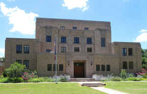
Menard County is a county located on the Edwards Plateau in the state of Texas. Based on the 2010 census, its population was 2,242. Its seat is Menard. The county was created in 1858 and later organized in 1871. It is named for Michel Branamour Menard, the founder of Galveston, Texas.
Etymology - Origin of Menard County Name
Michel Branamour Menard, the founder of Galveston, Texas
Demographics:
County QuickFacts: CensusBureau Quick Facts
Menard County History
Menard County is a county located in the US state of Texas. Its seat is Menard. Menard County is named for Michel Branamour Menard, the founder of Galveston, Texas.
Handbook of Texas Online
James and Rezin Bowie traveled to the San Saba valley in the early 1830s to
look for a silver mine that the Spanish had believed to be in the area. They were unsuccessful, but the legend of
the Lost Bowie Mine, also known as the Lost San Saba Mine or the Los Almagres Mine, fed the imagination of
treasure-seekers for the next 150 years. The Menard area was part of the Fisher-Miller Land Grant,
made by the Republic of Texas in 1842, but few if any of the German immigrants
who settled within the limits of the grant came so far west. Little settlement occurred until several years after
the annexation of Texas to the United States. In 1852, in order to protect
settlers from Indian attacks, the United States War Department established Camp San Saba, later known as Fort
McKavett, near the head of the San Saba River. Menard County was formed from Bexar County by the state legislature
in 1858 and named for Michel Branamour Menard, the founder of Galveston.
Menardville and Camp San Saba attracted settlers who came west, but with the withdrawal of troops from Camp San Saba
in 1859, the threat of Indians attacks delayed new settlement and caused many established residents to leave. The
remaining residents attempted to organize the county government in 1866, but when the attempt failed the legislature
placed Menard County under the jurisdiction of Mason County. When Fort McKavett was opened in 1868, people again
moved into the area. Menard County residents finally elected their own officials in 1871 More at
Vivian Elizabeth Smyrl, "MENARD COUNTY," Handbook of Texas Online (http://www.tshaonline.org/handbook/online/articles/hcm11),
accessed January 24, 2016. Uploaded on June 15, 2010. Published by the Texas State Historical Association.
Geography: Land and Water
As reported by the Census Bureau, the county has a total area of 902 square miles (2,337 km2), of which, 901
square miles (2,336 km2) of it is land and 1 square miles (1 km2) of it (0.04%) is water.
Neighboring Counties
Bordering counties are as follows:
- Concho County (north)
- McCulloch County (northeast)
- Mason County (east)
- Kimble County (south)
- Schleicher County (west)
Education


Click Image to Enlarge
